Introducing Cesium OSM Buildings
We are thrilled to announce Cesium OSM Buildings, a 3D buildings layer covering the entire world built with OpenStreetMap building data. It is the latest addition to our suite of Cesium Global Base Layers including worldwide terrain, aerial imagery, and streetmaps already available on Cesium ion.
Cesium OSM Buildings is a great base on which to layer high resolution data to provide urban context and a more immersive experience. Crowd-sourced and regularly updated, this foundation will serve endless use cases, from cities that need shareable 3D solutions for things like urban planning, tax assessment, or traffic management, to builders who want to visualize BIM models of their project in real-world context, to government agencies who need innovative tools for training and simulation.
Cesium OSM Buildings is included in every Cesium ion subscription starting today, and included by default in any new Cesium Stories you create. You can also add it to a CesiumJS application with some simple code:
var viewer = new Cesium.Viewer('cesiumContainer');
viewer.scene.primitives.add(Cesium.createOsmBuildings());
Cesium OSM Buildings consists of over 350 million buildings. While the full dataset is hundreds of gigabytes in size, through the magic of 3D Tiles it can be efficiently streamed and visualized over the web. 3D Tiles is an open standard, so Cesium OSM Buildings can be used in any compatible viewer, in addition to the open-source CesiumJS.
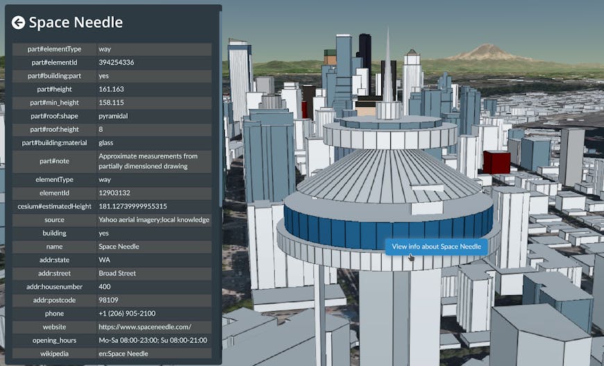
OpenStreetMap means rich metadata in most cities, like building name, address, and opening hours.
Cesium OSM Buildings are seated firmly on Cesium World Terrain, have their edges nicely outlined, and are individually selectable and styleable. In most cities, rich metadata associated with each building - and even individual parts of buildings - enable useful on-the-fly styling. For example, we can easily highlight all commercial and residential buildings to see patterns in different neighborhoods across the city.
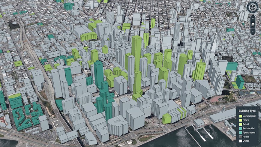
Highlighting all offices and commercial buildings in green using Cesium Stories.
Cesium OSM Buildings is derived from OpenStreetMap, the famous community-driven mapping project. This means that anyone can improve the dataset! If you’ve ever contributed, Thank you!
Please try out the data and let us know what you think. We look forward to seeing what you build!