Build fast
Open platform designed for interoperability and ease of integration
Cesium is the open platform for building 3D geospatial applications to better understand the operational environment.
Try it free with a community Cesium ion account.
Cesium is proud to collaborate with
Open platform designed for interoperability and ease of integration
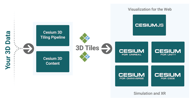
Leverage the world's fastest 3D tiling pipelines maintained by the creators of 3D Tiles
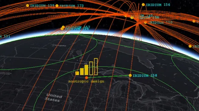
Enable faster decision-making and improved all-domain situation awareness
Deploy the Cesium platform in your secure environment to provide 3D geospatial capability for mission-critical applications—fast. Benefit from our leadership in open standards and from open source's rapid innovation cycles to create apps in browsers, game engines, or your custom software.
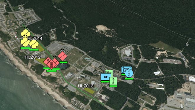
Cesium common operational picture (COP), Fort Story, Virginia.
View live demo
Powering training, planning, operations, and analysis across the Department of Defense and the United States Intelligence Community.

Flight tracker mode in Project Anywhere, a collaboration between Cesium, Microsoft, Epic Games, and NVIDIA.
Cesium for Unreal is the first high fidelity WGS84 globe to be streamed into a leading game engine, combining Cesium’s global scale, precision, performance, and interoperability with Unreal Engine’s stunning visual quality.
Cesium for Unity brings real-world 3D geospatial capability to the Unity ecosystem.
Cesium for Omniverse is a real-world 3D geospatial extension for NVIDIA omniverse.
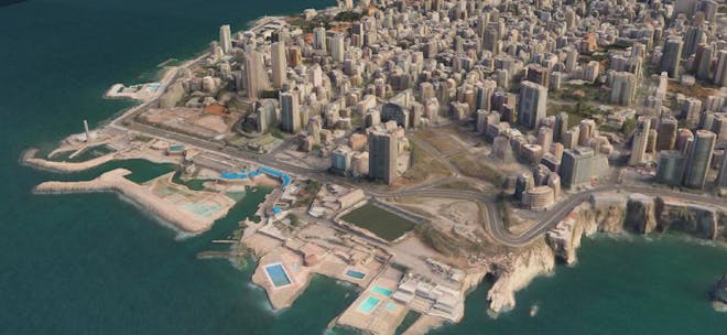
3D Surface Model of Beirut, Lebanon.
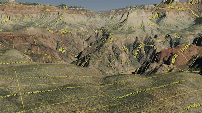
Cesium works with Vantor (formerly Maxar Intelligence) to build the US Army’s One World Terrain (OWT) Well Formed Format on 3D Tiles for high-speed creation, processing, and dissemination of high-resolution terrain.
This realistic, common, accessible, and automated 3D terrain dataset is usable by all simulation trainers that represent the complexities of the operational environment (OE) in support of training as provisioned through the STE.

Cesium team members visit the Battleship New Jersey outside of Philadelphia.
Trusted by partners like Lockheed Martin, CAE, and Vantor, our team of experts in 3D graphics and geospatial visualization builds open, robust solutions at the speed of innovation. With over 2,000,000 lines of code developed with agile practices, Cesium applies uncommon skills to the hardest problems in 3D geospatial.
Why 3D visualization matters now
Time-dynamic 3D enables leaders to coordinate information and action across the domains of synchronized space, cyberspace, air, land, and sea.
Enabling game engines with WGS84 geospatial via Cesium
Game engines such as Unreal and Unity have the potential to advance training simulations; Cesium is applying our deep knowledge in real-world global-scale visualization and analysis to geospatial-enable game engines with accurate support for the One World Terrain (OWT) Well Formed Format (WFF).
Cesium on-premises: overview deck
Cesium's open platform provides market-leading capability for mission-critical applications, allowing users to make the most of their data in precise 4D visualizations. See and share what we deliver today, and contact us to see how we can partner on building the future of 3D geospatial.
Building JADC2 and C5ISR solutions on 3D Tiles Next
Cesium and the new 3D Tiles Next protocol enables new technologies for JADC2 and C5ISR, packaged for easy, scalable, secure deployment all the way to the tactical edge.
3D Tiles overview
An approachable guide for adopting 3D Tiles.


Federal Business Development
Trent grows Cesium’s business by showing customers how Cesium’s commercial offerings can meet their geospatial needs.
Cesium GS, Inc.
400 Market Street
Suite 1100
Philadelphia, PA 19106
CAGE: 8E2N3
DUNS: 037969168