RikiTraki’s Hiking Tracks on the Web Evolve Alongside CesiumJS
Written by  Sarah Chow,
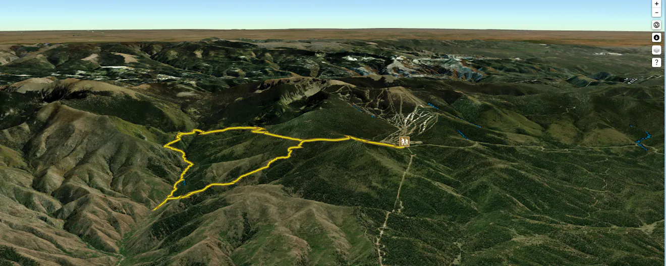
Over a decade ago, we showcased RikiTraki, a CesiumJS application built by Ricardo Morin for recording hiking trails. Ricardo was one of the first people to see the potential value of Cesium’s high accuracy 3D terrain rendering for outdoor sports. RikiTraki, a place to upload GPX tracks and photos from hikes, was largely a personal project, but Ricardo made it open to the public—and open source.
In CesiumJS, Cesium ion, User Stories
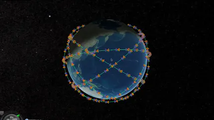
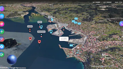
Cesiumで可視化する軌道上AIと衛星ネットワーク ―― NTTが探る「宇宙データセンタ」アーキテクチャ
Written by Gen Kukita,
In User Stories, Cesium ion, CesiumJS, Aerospace

Bringing Earth to the Treadmill with Cesium
Written by Sarah Chow,
In Cesium for Unreal, User Stories, Photorealistic 3D Tiles, Sports & Events, Media & Entertainment
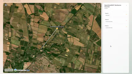
The Cross Product Transforms Raw LiDAR Data into Actionable Infrastructure Insights with Cesium
Written by Sarah Hunter,
In 3D Tiles, User Stories, AEC, CesiumJS, Digital Twins

Geotour Showcases Crete with Synchronized Panoramas and Video in CesiumJS
Written by Sarah Chow,
In User Stories
Purdue University Exploring the Boundaries of XR with Cesium
Written by Sarah Chow,
In AR/VR, User Stories, Cesium for Unity, Photorealistic 3D Tiles
XRF Connects and Integrates Missions with Cesium
Written by Monica Witzig-Wamsley,
In Certified Developer, Modeling & Simulation, 3D Tiles, User Stories, Cesium ion Self-Hosted, Cesium ion, Cesium for Unity, CesiumJS, Federal & Defense