Farsight Strengthens Mission Planning with 3D Tiles
Military teams on frontlines often do not have access to information updated at the same rate as those at headquarters, but it’s often those teams that need immediate insights. Squads rely on Reveal Technology’s Farsight app for accurate and timely 3D models, enabling them to access relevant and actionable intelligence in disconnected or limited-bandwidth environments. To optimize rendering, Farsight uses 3D Tiles—an open specification created by Cesium for streaming massive heterogeneous 3D geospatial datasets and adopted as an Open Geospatial Consortium community standard.
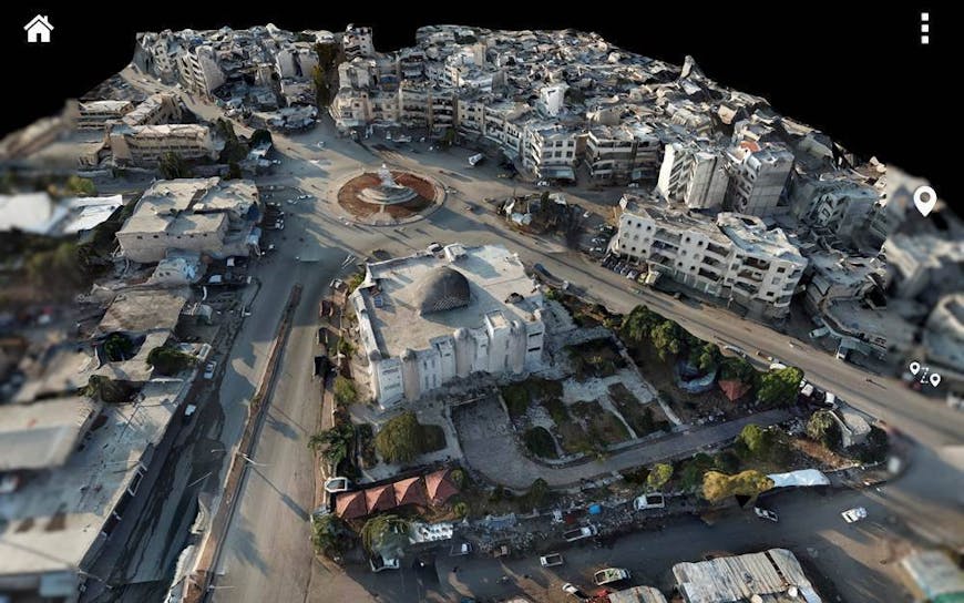
3D model of an urban center in Idlib, Syria, in Reveal’s Farsight app. Courtesy Reveal Technology.
Reveal Technology’s Farsight software, released in fall 2020, enables teams in the field to collect and analyze data via standard Department of Defense inventory unmanned aircraft systems and end-user devices like smartphones and tablets. Farsight Mobile uses full-motion video from UAS to generate 2D maps in real time; then, from the same footage, it generates 3D models as 3D Tiles. Farsight Node does the same in an enterprise environment, and Farsight Edge does this processing onboard the UAS to deliver a 3D model straight from the drone without the need to consume raw FMV, reducing network load. Prior to Farsight’s availability, creating 3D models in challenging environments was time intensive and high effort.
With Farsight, operators access 3D map data and AI features to make vital decisions in the field. Courtesy Reveal Technology.
Farsight previously employed generic .obj model formats. When a user would zoom in, however, the 3D model did not adjust; the resulting view was blurry. 3D Tiles enable Farsight users to explore areas of interest in greater detail and complexity without slowing down operations. 3D Tiles support rapid map creation and interoperability with various viewers, enhancing situational awareness and collaboration.
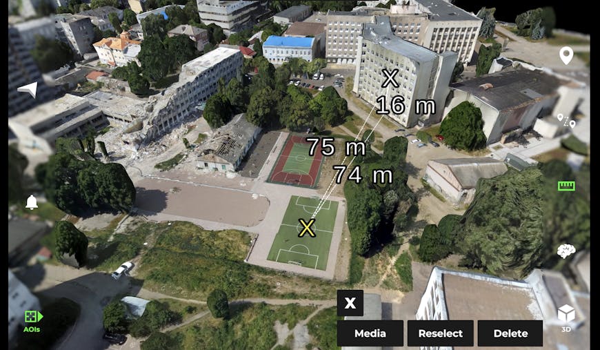
Using the Vertical Measurement Tool, Farsight users measure length, height, and diagonal from a specific point. This 3D model shows a city in Ukraine. Courtesy Reveal Technology.
Squads use Farsight to visualize and analyze in ways specific to their missions, including viewsheds, helicopter landing zones, and measurements. Farsight’s AI features and optimized 3D geospatial data enable evaluations of friendly and enemy points of view, changing tactical plans on the fly, and coordinating seamlessly to make better decisions faster.
Tackle the hardest problems in 3D geospatial with Cesium.