Agisoft Metashape Now Directly Supports Sharing 3D Models with Cesium ion
As 3D Tiles has gained widespread adoption as the preferred way for streaming massive 3D data on the web, more and more software platforms have added support for the open standard.
Many of the leading platforms for creating photogrammetry from drone captures, including ContextCapture, Reality Capture, Correlator3D, and Open Drone Map, have also added integrations to Cesium ion, allowing their users to export their data directly to Cesium ion where it can be tiled into 3D Tiles, hosted in the cloud, and combined with our global 3D datasets to be shared online.
With the release of Metashape 1.7.4, Agisoft has joined these companies with an integration to Cesium ion. Agisoft Metashape produces photogrammetry meshes from drone surveys and other captures. Many Metashape users are working in archaeology and cultural heritage to capture historical sites.
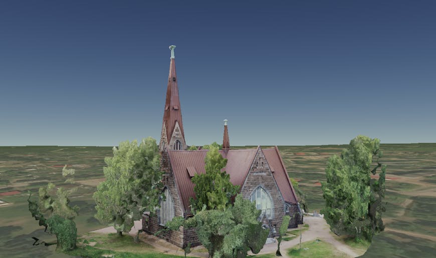
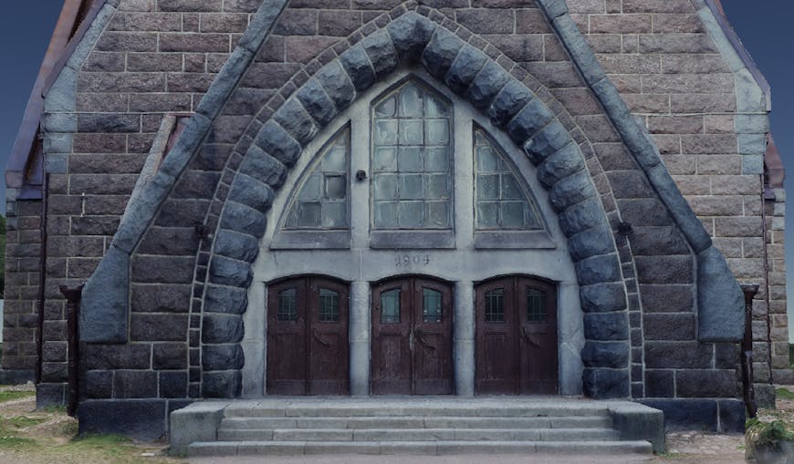
Photogrammetry model of 14th century Koivisto parish church in Primorsk, Russia. Created with Agisoft Metashape and visualized in Cesium. This visualization combines the 3D model of the church with Cesium World Terrain and imagery showing the surrounding landscape.
Metashape Professional Edition allows users to upload photogrammetric results directly to Cesium ion.
This allows users to share their photogrammetry models together with the surrounding terrain, imagery, and buildings. Since higher levels of detail are streamed in as users navigate the scene, it’s possible to share any size scan at full resolution, even if it has millions of triangles, so that all of the original detail is preserved.
This dataset was created from a combination of ground and aerial photographs, captured with a Phantom 4 RTK drone using the automatic mission planning feature in Agisoft Metashape. The model is tiled into 3D Tiles for smooth streaming online without any simplification.
Check out our integration guide to connect your tools to Cesium ion and give your users an easy way to share their large 3D datasets.