3D Tiles Now an OGC Community Standard for Streaming Massive 3D Geospatial Content
We are thrilled to announce that 3D Tiles has been adopted as a community standard for sharing, visualizing, fusing, and interacting with massive heterogenous 3D content by the Open Geospatial Consortium (OGC), an international consortium for promoting interoperable standards in the geospatial industry.
This collaboration between the geospatial and computer graphics communities will empower app developers to make massive and complex 3D information more accessible, interoperable, and useful across all kinds of tools and applications. Having 3D tiles recognized as a community-accepted standard accelerates its adoption and the growth of its supporting ecosystem, including improved data pipelines and visualization optimizations in the Cesium platform itself.
Here are some examples of what you can do with 3D Tiles and your geospatial data:

Photogrammetry model covering about 150 square kilometers of Melbourne, Australia, tiled using Cesium ion from 10 centimeter resolution data provided by Aero3DPro. With 3D Tiles, this massive model streams seamlessly on the desktop and on mobile devices.
Point clouds of the interior of historic cabins in Pharsalia, Virginia, sampled at sub-centimeter precision by Trimble, Inc.’s terrestrial scanners and visualized in CesiumJS. 3D Tiles is designed for geospatial data of any scale, from global to local to building interiors.
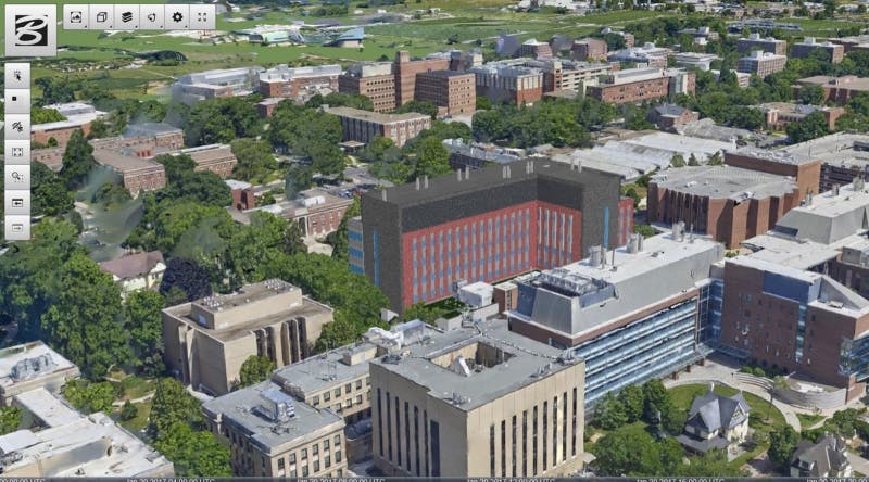
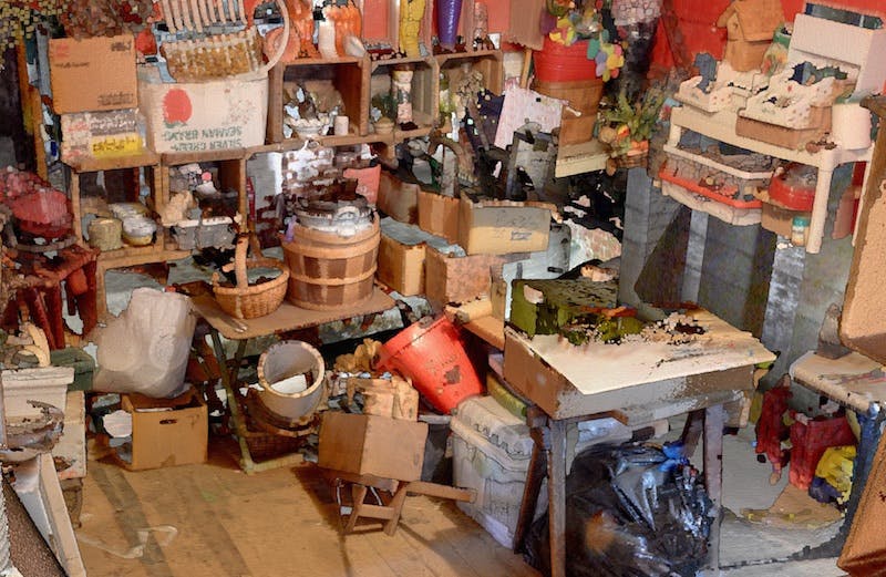
3D Tiles supports heterogeneous datasets. Here in a scene of Penn State University, a proposed Chemistry building CAD model is fused with existing photogrammetry data in a CesiumJS app, courtesy of Bentley Systems.
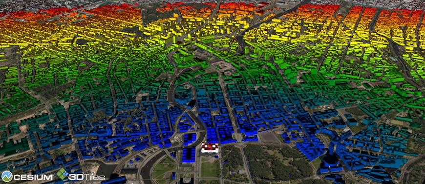
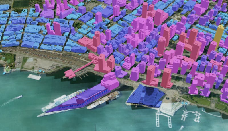
Because 3D Tiles preserves metadata, features are styleable. A CityGML model of Berlin with 540,000 textured buildings was tiled in Cesium ion and is visualized in CesiumJS, colored based on distance from the Reichstag (bottom center) using a 3D Tiles style.
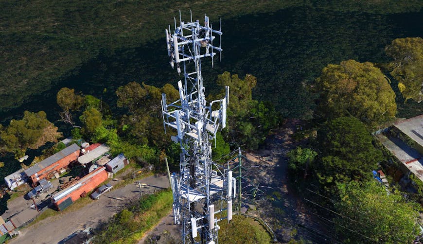
As an open standard, 3D Tiles can be visualized by CesiumJS or any other 3D engine. In this scene, a high-resolution cellphone tower site from SiteSee is visualized using three.js.
The ecosystem of tools supporting 3D Tiles is growing. Here, CesiumJS visualizes a 3D buildings tileset of Vancouver, generated from footprints and tiled via integration with Cesium ion in FME by Safe Software.
Since the introduction of 3D Tiles in 2015, it’s been amazing to see the flourishing community that has contributed to and implemented this open standard right alongside the Cesium team. Our early prototypes were motivated by the need to efficiently visualize 3D buildings. But, to handle the ever-growing collection of 3D geospatial data, the need for streamable, optimized formats is rapidly expanding across data types and industries. We’ve already seen the adoption of 3D Tiles in industries from drone data collection to indoor mapping to digital twins to emergency response efforts - and expect to see many more uses in the near future.
Cesium ion provides 3D tiling for a variety of source data. Join the 3D Tiles community and upload data to generate your first 3D tileset for optimized streaming into Cesium apps.