Interactive Visualization for Protecting the Wilderness and Wildlife in Oregon
HOWL(Highlighting Oregon’s WildLands) is an interactive 3D/4D mapping and visualization tool for presenting information relevant to protecting wilderness and wildlife in Oregon. The application combines information from multiple data sources and presents it over 3D maps, and, when applicable, it provides the ability to animate the data presentation over time.
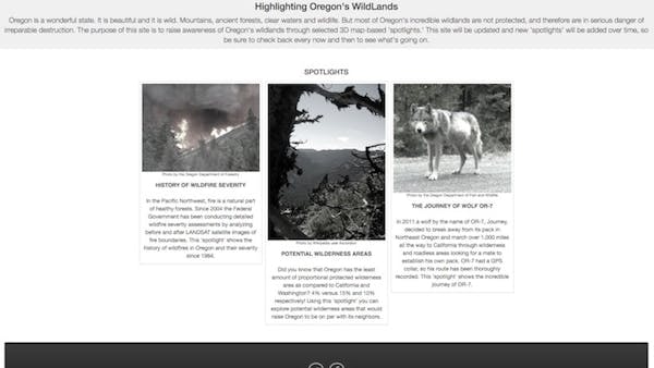
HOWL uses spotlights, introduced in the form of cards on the home page, to show information. Spotlights are mini-applications focused on specific topics or areas of interest. Currently HOWL has the following three spotlights available:
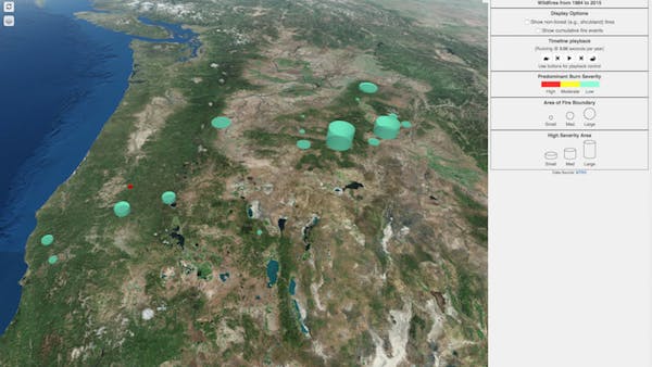
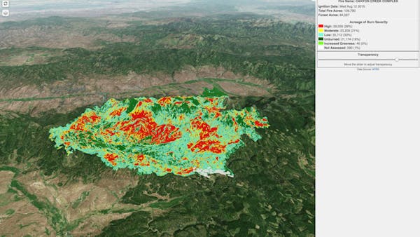
- History of Wildfire Severity: Animation of wildfire events since 1984, with drilldown to individual fires and color-coded severity assessments.
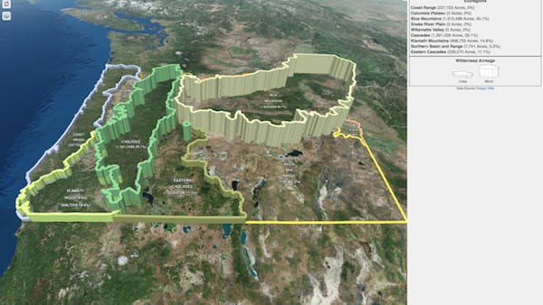
- Potential Wilderness Areas: Shows candidate areas for wilderness designation protection categorized by ecoregion.
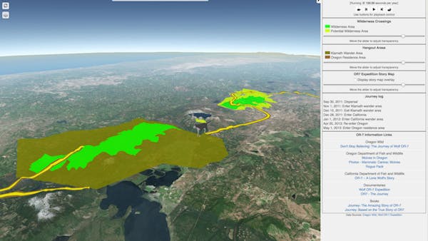
- The Journey of Wolf OR-7: Visualization and time animation of the migration route taken by the famous OR-7 wolf from northeastern Oregon all the way to California and back to Oregon’s Crater Lake area.
Spotlights are modules that can be added to HOWL. In the future, more spotlights will be added to focus on other areas related to wilderness protection. Some ideas under consideration include active wildfires, forest-based carbon storage, and additional wildlife tracking.
HOWL is built using Cesium and takes advantage of many of its features, including 3D data representation, time animation, CZML, terrain model, and imagery overlay layers. HOWL integrates additional open-source components such as ChartJS, JQuery, and BootsrapJS.
HOWL is a volunteer project made for Oregon Wild. The application is regularly updated with new features, and it is published as open source on GitHub. Contributions are welcome! Stay in touch by visiting the author’s blog.