Terradepth Displays Sea Floor 3D Models with CesiumJS
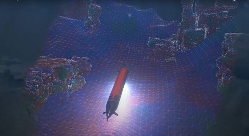
In some ways, Earth’s oceans are more mysterious and less explored than outer space. Terradepth is changing this with its autonomous underwater vehicles (AUVs) and its Absolute Ocean (AO) browser-accessible data management and analysis platform, which uses CesiumJS to visualize vast 3D models of the ocean floor.
Terradepth’s Absolute Ocean uses CesiumJS to visualize vast 3D models of the ocean floor. Courtesy Terradepth.
Terradepth addresses both data collection and dissemination, beginning with making thousands of NOAA surveys available to all users of its AO platform, where users can see everything from the natural seabed to sunken wrecks. Terradepth also collects geospatial seafloor data using its own fleet of AUVs and partners with TCarta to add its satellite-derived bathymetry; customers are able to add their own survey data to AO, too. Terradepth announced AO in spring 2022 and launched the platform this summer.
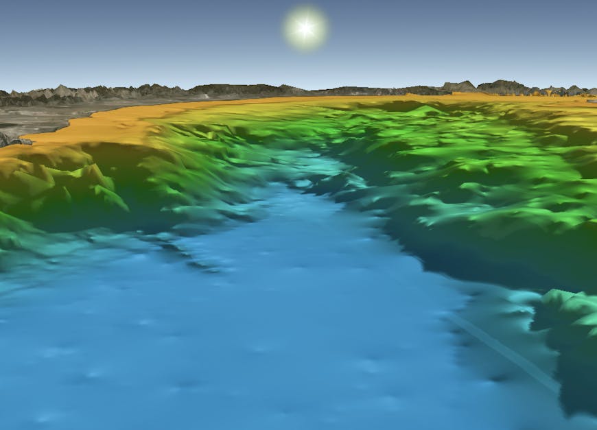
Terradepth collects geospatial seafloor data using its own fleet of AUVs. Courtesy Terradepth.
Terradepth uploads data in BAG, GeoTIFF, JSF, LAZ, and XYZ formats to Cesium ion, where that data is stored and the point clouds are tiled as 3D Tiles. For images and grids, Terradepth uses the 2D imagery and quantized mesh outputs from the tiler. Terradepth also accesses Bing Maps Aerial imagery and Cesium World Terrain for detailed above-sea-level context. All of this is streamed into CesiumJS and shown in the AO portal, so clients can map ocean change over time and share dashboards broadly with a community or with a smaller team—to collaborate and make the best decisions with the data they have about the ocean.
“Cesium was our first choice for Terradepth's AO platform. Its open source JavaScript library jumpstarted our AO development and it has allowed us to customize our own basemap to enable a striking 3D navigable underwater environment,” said Andrew Lunstad, Terradepth’s SVP of Software.
AO users can map ocean change over time and share dashboards. Courtesy Terradepth.
AO’s power users are hydrographers, using bathymetric data to aid underwater projects for laying cable, pipelines, offshore wind farms, and others. Any organization building, navigating, or studying underwater needs to know where there are boulders, cliffs, existing infrastructure, shipwrecks, and unexploded ordnance.
Terradepth’s ocean focus is what led to its partnership with Seabed 2030, a project that aims to map the world’s entire ocean floor by 2030 via crowdsourced bathymetry and make it available to everyone. AO will be the secure platform for Seabed 2030 data contributors, enabling interactive visualizations and examining the relationships to other open-source data added to AO.
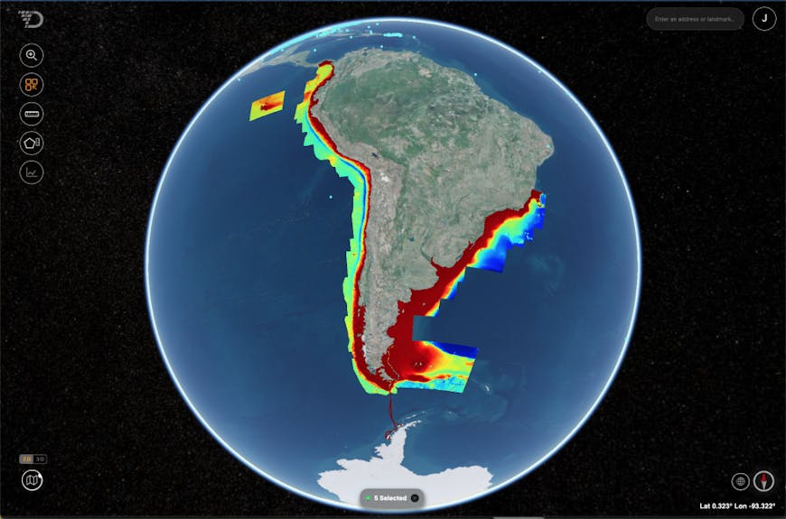
Data collected around South America and transit from South America to Antarctica and back, depicted in AO for Seabed 2030. Courtesy Terradepth.
With CesiumJS, Terradepth’s AO can provide world-class 3D maps to organizations and their survey teams in energy, telecommunications, academia, defense, and others who are exploring the watery unknown on our planet.
Bring your undersea, terrain, and 3D data to a Cesium globe with a Cesium ion account.