Visualize Vertical LiDAR Curtains with NASA's Data Curtains from Space
NASA’s Data Curtains from Space is a Google Summer of Code 2015 Project for the Cesium Community developed by Abhishek Potnis under the guidance of Mike McGann and Ryan Boller at NASA.
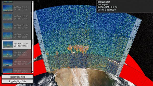
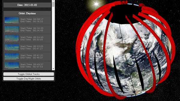
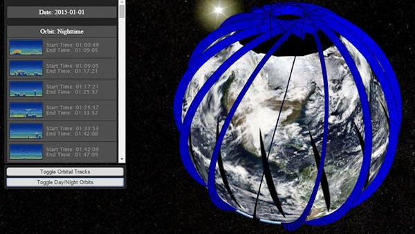
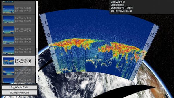
The CALIPSO satellite is used to study clouds and aerosols in the atmosphere. It probes the vertical structure of the atmosphere using a combination of active LiDAR, passive infrared, and visible imagers. Due to the vertical nature of LiDAR profiles data, visualizing them with their satellite orbital tracks and other satellite flat map products is difficult. Currently, most of the visualizations show side-by-side imagery of LiDAR data and CALIPSO orbital tracks, making it difficult to connect the LiDAR data with any flat-map satellite product.
Data Curtains from Space uses Cesium to better visualize this data. WallGeometry, offered by Cesium, is used to visualize the vertical LiDAR profiles with CALIPSO orbital tracks on the globe. The MODIS Aqua reflectance base layer provides a reference for understanding the vertical LiDAR profiles. Information such as the height of the LiDAR profile can be used for analysis of aerosol and cloud formation processes in the atmosphere.
Data management is another aspect of this project, given the legacy data from NASA satellites. A methodology for extracting metadata and generating imagery from .hdf files of CALIPSO, to be consumed by the application, has been proposed and implemented as a part of this project. The project source can be found here.
Future directions for this project involve:
- Exploring faster and more efficient methods for image generation and metadata extraction from .hdf files
- Generating imagery and extracting metadata on-demand, instead of pre-generating the data
- Improving image quality of daytime LiDAR profiles, when generating imagery from .hdf files of CALIPSO satellite