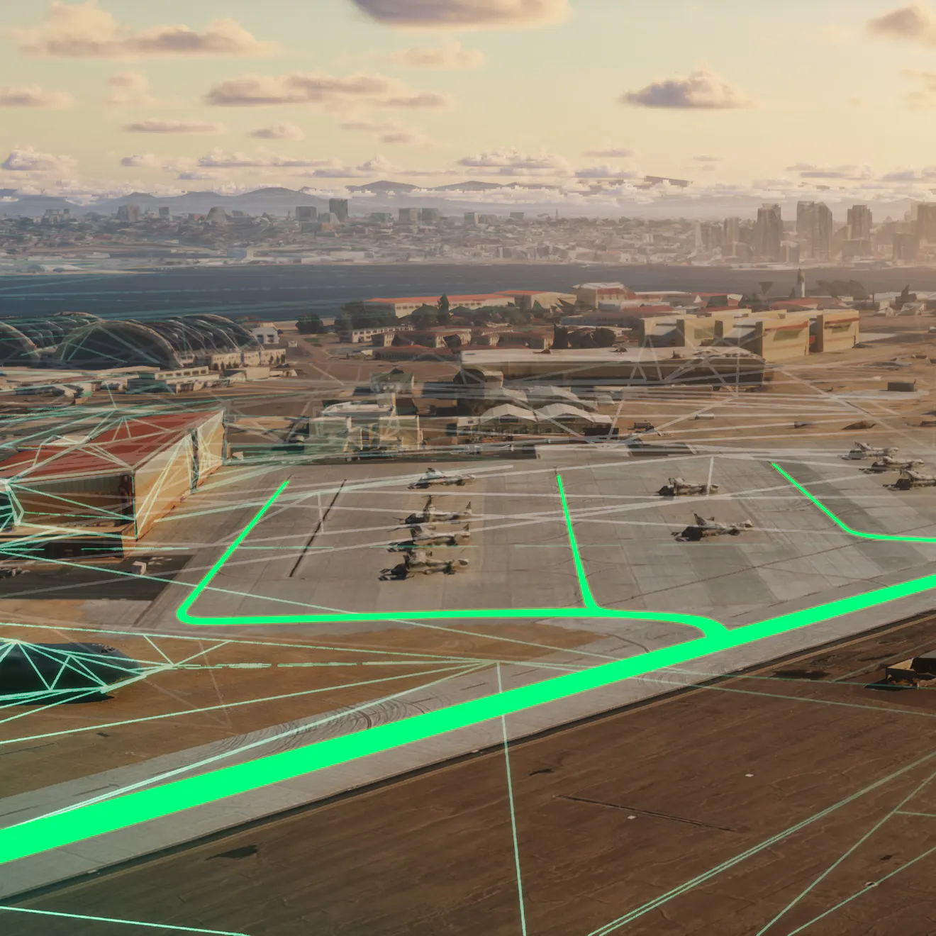
Osprey helicopter over a port with aircraft. Mesh is on the left. Vector data in the middle and right.

Cesium at I/ITSEC 2026: Interoperability from Training to Operations

November 30-December 3, 2026

Orlando, Florida, USA

BOOTH 271

Explore how Cesium powers the modeling, simulation, and training community. 

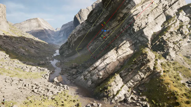
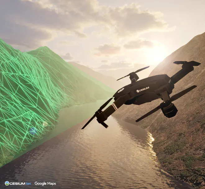
Drone flying through a canyon, scanning terrain, which is seen as the triangular mesh.

3D Tiles 2.0

The next major evolution of the standard has been submitted to the Open Geospatial Consortium, and the ratification vote is underway. 

3D Tiles 2.0 enables more of the data needed for mission planning, simulation, training, change analysis, and situational awareness to participate in an interoperable 3D environment. 3D Tiles 2.0 includes six major capability areas: 

  • deeper integration with glTF, 
  • time-dynamic content, 
  • volumetric data through voxels, 
  • 3D-native vector data, 
  • AEC and infrastructure workflow extensions, and 
  • 3D Gaussian splats.
Learn more
Join us for happy hour: Tuesday, December 1, 3-5 p.m. Booth 271.

Enjoy drinks, appetizers, and great company during happy hour 3-5 p.m. Tuesday, December 1, at the Cesium booth.

Join the Unreal Engine Simulation team to explore the next generation of world building with Unreal Engine 5.8's Mesh Terrain, currently in Experimental.

Booth partner: Epic Games Unreal Engine simulation team

Explore the latest capabilities in Cesium for Unreal, enabling Gaussian splatting, vector tiles, and stylization with real-world 3D data via Cesium ion. Epic's simulation team will also showcase a Mesh Terrain demo, Procedural Content Generation use cases, and Unreal MCP and AI-assisted application development. 

Learn more
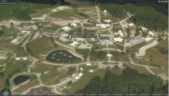
One World Terrain Well Formed Format is an extension of 3D Tiles, including predicted accuracy in the NGA Generic Point-cloud Model (GPM) format.

One World Terrain Well Formed Format is an extension of 3D Tiles, including predicted accuracy in the NGA Generic Point-cloud Model (GPM) format.

OGC 3D Tiles and Well Formed Format

The One World Terrain Well Formed Format is an extension of 3D Tiles, enabling streaming of massive 3D datasets. We will feature sample data from One World Terrain, for which Cesium is proud to support the US Army and Vantor (formerly Maxar Intelligence). Use the same data across training, planning, execution, and analysis.

Learn more
Cesium ion Self-Hosted

Cesium ion Self-Hosted

Move your solution to the high side or a disconnected environment with Cesium ion Self-Hosted. Host, tile, and stream massive heterogeneous 3D geospatial datasets in your own environment, such as the Cloud, your data center, or edge devices. 

Production-ready Cesium Global 3D Content is available fully offline.

Learn more
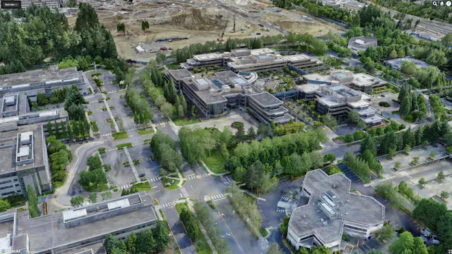
3D Gaussian splatting tileset of Microsoft Redmond Campus, as viewed in CesiumJS. Captured in partnership with Bentley Systems. This tileset uses 20,169 photos (427.7 gigapixels, DJI FC6310 camera) and covers an area of about 3.7 sq km, with mean ground sampling distance 3 cm. The reconstruction is 110 million splats.

3D Gaussian splatting tileset of Microsoft Redmond Campus, as viewed in CesiumJS. Captured in partnership with Bentley Systems. This tileset uses 20,169 photos (427.7 gigapixels, DJI FC6310 camera) and covers an area of about 3.7 sq km, with mean ground sampling distance 3 cm. The reconstruction is 110 million splats.

Reality modeling and analysis

Built on iTwin Capture technology, Cesium ion’s reality modeling and analysis capabilities enable reconstruction of 3D reality models from photos, such as high-res drone imagery. Improve situational awareness with a unified view by combining your reality data with Cesium Global 3D Content. Run AI-powered reality analysis on point clouds for segmentation and embedded metadata. Reality modeling and analysis capabilities are available in Cesium ion SaaS and Cesium ion Self-Hosted. 

See how the iTwin Capture suite natively supports advanced aerospace and defense visualization workflows, including high-quality orthomosaics, 3D Tiles 1.1, and Gaussian splatting with hierarchical LOD. 

Learn more
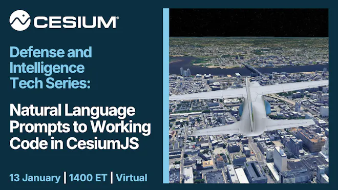
Text on the left: Cesium Defense and Intelligence Tech Series: Natural Language Prompts to Working Code in CesiumJS. 13 January, 1400 ET, virtual. Image on the right: AI-coded Cesium flight tracker app.

Cesium Defense and Intelligence Tech Series: Natural Language Prompts to Working Code in CesiumJS

Virtual quarterly training and technical exchange for US government employees and contractors—bring edge cases and hard questions

Natural language and AI-assisted development workflows can accelerate prototyping, helping you get from an idea to a working CesiumJS app faster, with or without deep development experience.

In this training, we'll cover:

- LLM integration patterns for generative UI and spatial analytics,

- automated shader, entity, and camera script generation, and

- accelerated prototyping workflows for tactical front-ends.

This webinar series is available to only US government employees and contractors; use your .gov or .mil email address when registering and attending.

Learn more
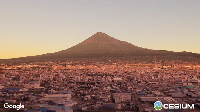
Mount Fuji, Japan, visualized with Photorealistic 3D Tiles using Cesium for Omniverse.

3D geospatial community in Japan

Cesium proudly supports users in Japan with datasets, data residency, webinars, in-person events at our Tokyo office, and native speakers.

Learn more

Cesium Certified Developer program

The Cesium Certified Developer program recognizes your technical expertise in building on the Cesium platform. The program is free and open to anyone. Becoming a Cesium Certified Developer enables you to connect and collaborate with the greater 3D geospatial ecosystem.

Learn more
Gabby Getz, with Janine Liu and Xuelong Mu, testing VR applications in Cesium

Join our team

Cesium is a team of passionate individuals working together to build the open platform for 3D geospatial through innovation, collaboration, customer focus, and continuous learning. Whether you’re an industry veteran or just starting out, you’ll get to work on interesting and challenging problems.

Learn more