Introducing Cesium Moon Terrain
Editor's note: We renamed this dataset to Cesium Moon in September 2025.
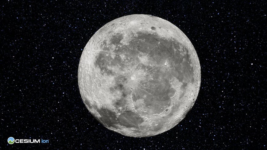
Today, we are thrilled to share that Cesium Moon Terrain, the first readily accessible single, comprehensive 3D Tileset of the Moon, is now available.
Cesium Moon Terrain is composed of precise terrain and imagery from NASA’s Lunar Reconnaissance Orbiter (LRO) program and other sources, and is provided as 3D Tiles, the Open Geospatial Consortium Community Standard created by Cesium.
“We launched Cesium Moon Terrain as an accurate and interoperable 3D Tiles canvas to support the international interest in lunar exploration and building structures on the moon's surface,” said Cesium CEO Patrick Cozzi. “Cesium Moon Terrain will enable engineers, system integrators, and digital content creators to build simulations, mission plans, and real-time operations experiences.”
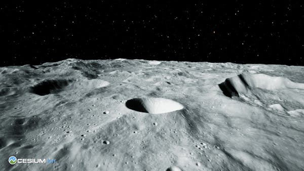
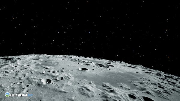
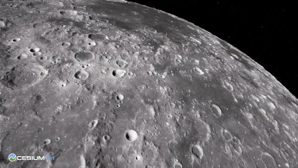
Cesium Moon Terrain visualized in Cesium for Unreal
Cesium Moon Terrain was recently demonstrated at the Digital Twin for Lunar Development Workshop held at NASA’s Jet Propulsion Laboratory. The workshop brought the space enterprise community together to focus on advancing digital twins for NASA and the creation of an open, interoperable platform for a lunar digital ecosystem.
As early adopters, Ansys has utilized 3D Tiles in both their Systems Tool Kit (STK) and their RF Channel Modeler software to help users easily incorporate geospatially accurate datasets into their digital mission modeling and systems modeling engineering capabilities. Users are able to directly understand impacts of terrain in challenging locations such as lunar polar regions to accurately analyze communications system designs.
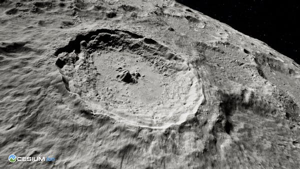
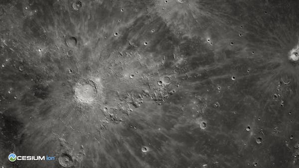
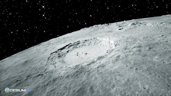
The Copernicus Crater, visualized in Cesium for Unreal
Another early adopter, Buendea, is collaborating with the NASA Advanced Operations Concept Lab on developing the XR Operations Support System (XOSS) to support real-time simulations on the Moon and Mars. Buendea is interested in Cesium Moon Terrain for its potential to enhance their ongoing projects.
“We’re excited about the potential of Cesium Moon Terrain to accelerate our work, including our efforts with NASA, to accurately plan and simulate explorations of the lunar surface,” said Julian Reyes, Founder of Buendea.
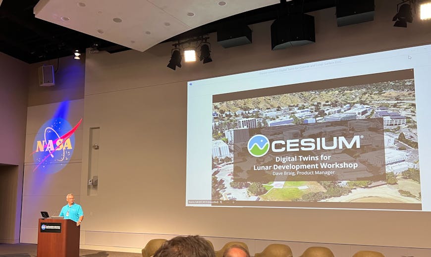
Cesium's Dave Braig presenting at the Digital Twins for Lunar Development Workshop at NASA's JPL
To access Cesium Moon Terrain, sign up for an account, or sign in to Cesium ion and add the tileset to your Asset Library from the Cesium ion Asset Depot. Once added, create a Cesium Story, incorporate the data into a web application with CesiumJS, or build advanced visualizations with Cesium for Unreal and Cesium for Unity.
Each of these visualization engines have been updated to enable non-WGS84 based ellipsoids to support an accurate representation of the lunar surface for analysis and measurements. Cesium Moon Terrain is also available for Cesium ion Self-Hosted.
With Cesium Moon Terrain, users can leverage the same workflows and functionality already available in our open source runtime engines. Use Cesium Moon Terrain as a base layer to place models of habitats, vehicles, or rovers on the lunar surface. If you have your own high resolution terrain data, clip and inset it within Cesium Moon Terrain so that your projects can live within a single continuous 3D surface rather than multiple separate project areas.
NASA's ambitious Artemis program aims to return humans to the Moon and eventually land them on Mars. With this, along with initiatives from SpaceX, Boeing, BlueOrigin and others, the demand for an open, interoperable, standards-based platform has never been greater. Cesium Moon Terrain meets this demand, providing a versatile foundation for countless applications.
We look forward to seeing your projects built with Cesium Moon Terrain! Sign up or sign in to get started.
Updated 8/8/24