


Simulate the experience of being there with CesiumJS and Cesium for Unreal.
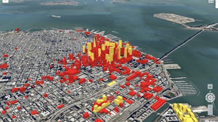
Real estate decisions depend on location-specific data, such as nearby demographics. A 3D experience communicates this information more effectively and creates an emotional connection. Real estate solution providers choose Cesium to help them combine the data, visualization, and analytics that generate insight and excitement.
Simulate the experience of being there with CesiumJS and Cesium for Unreal.

Using Cesium ion, combine your high-resolution drone data and BIM models with global 3D content to rapidly create a digital twin that can be accurately visualized in a real-world environment.
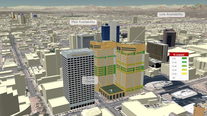
In the realistic 3D geospatial context, display property availability, price, and other factors that support decision-making.