Bring your own 3D data
Upload your data to create 3D Tiles, the optimal way to stream massive 3D content.


Cesium ion SaaS is a robust, scalable, and secure platform for 3D geospatial data. Upload your content and Cesium ion will optimize it as 3D Tiles, host it in the cloud, and stream it to any device.
Cesium ion includes access to curated global 3D content including Cesium World Terrain, Bing Maps and Google Maps imagery, and Cesium OSM Buildings. Combine these assets with your own data to see it in a geospatial context, and share the results securely with your colleagues or make them available through your apps.
Upload your data to create 3D Tiles, the optimal way to stream massive 3D content.
Combine your data with high-resolution terrain and imagery or even buildings for global coverage and show where your data fits in the world.
Our hosting is tuned to serve massive 3D datasets as quickly, efficiently, and securely as possible.
Cesium Stories lets you easily create and share map-based stories without writing code.
Cesium ion integrations enable a seamless flow of 3D data from creation and capture, to tiling, to streaming for visualization, simulation, and gaming.
Stream Cesium World Terrain to 50 cm and Bing Maps Imagery to 15 cm resolution.
Explore our collection of global 3D content, and combine it with your own data for more complete coverage and accurate analysis.

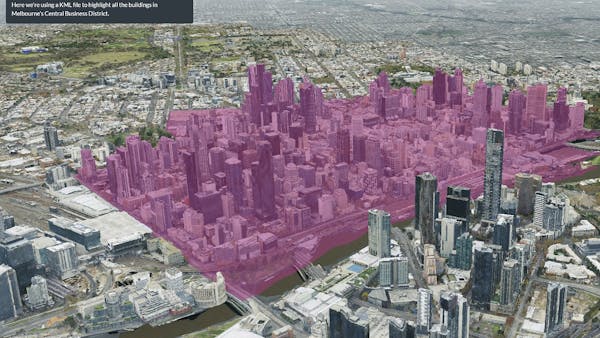
3D Tiles of 3D buildings in Manhattan in Cesium ion. Data source: Nearmap
Cesium ion tiles your massive high-resolution 3D content into 3D Tiles for optimized and efficient streaming over the web.
Optimize massive 3D content with tools built to scale for lightning fast processing.
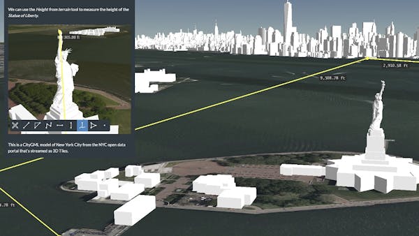
Measure, analyze, and make decisions with confidence based on visualizations as precise as your source data.
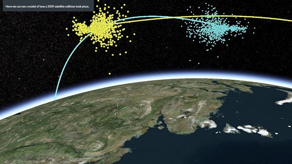
Cesium Stories lets users create 3D geospatial presentations with an easy-to-use editor.
Cesium Stories lets you build and share 3D geospatial presentations and stories on the web without writing code.
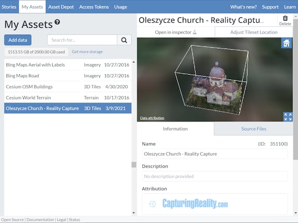
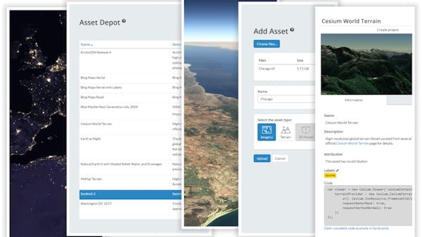
Cesium ion user interface
Cesium's cloud-based infrastructure is built to host massive and complex geospatial datasets securely and privately for each account.
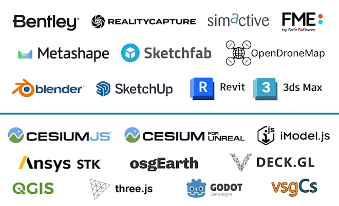
Cesium ion is easy to integrate into your existing data creation, capture, and streaming workflows.
Learn how to build an interactive 3D flight tracker.