VRAI Delivers Virtual All-Domain Environment with Cesium for Unreal
To modernize defense planning and rehearsal, VRAI used Cesium for Unreal to build the Virtual All-Domain Environment (VADE), enabling users to deeply examine areas of interest before arriving.
VADE uses Cesium to mirror operational reality. Courtesy VRAI.
An immersive XR platform in the works since 2021, VADE began as a proof of concept between simulation data company VRAI and the Royal Air Force for comprehensive situational awareness and could scale across Defence. VRAI announced VADE’s full release at DSEI in fall 2025.
Real-world 3D data and live collaboration in VADE enable a common operating picture (COP) for detailed planning and faster decisions. Add XR, and troops familiarize themselves with a location before deploying. VADE can be set for individuals or in multiplayer mode, accessed via desktop app or with headsets.
The tool’s capabilities span domains:
- For drone intervisibility studies, users can draw routes, mark waypoints at each kilometer, and determine blind spots at specific locations and heights to ensure proper placement anywhere on the globe.
- With a volumetric tool for battlespace management and deconfliction, airspace coordination via VADE is accurate and intuitive.
- High-altitude parachute insertion simulations include trackback lines for descent, giving the distance to the drop zone throughout the line; users can view the line from the aircraft or the ground, with the surroundings they can expect to see.
- Because VADE allows users to customize for NATO standards, slopes turn red if they’re not sufficient for helicopter landing sites (HLS).
- Although VADE is not a targeting tool, users can examine the impacts of explosives.
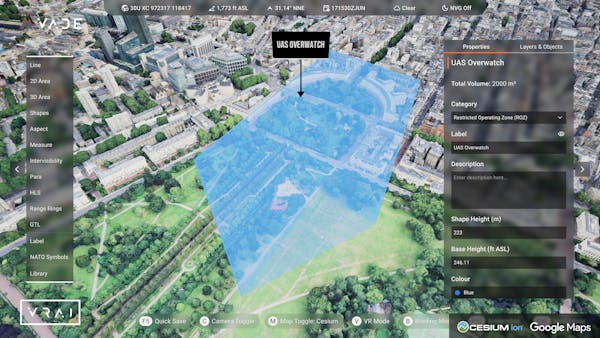
Restricted operating zone for UAS overwatch. Courtesy VRAI.
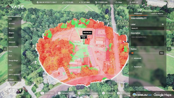
Intervisibility study to ensure proper placement. Courtesy VRAI.
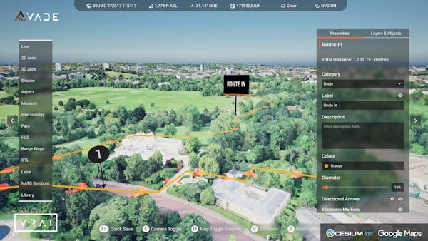
Route planning, with directional arrows and optional kilometer markers. Courtesy VRAI.
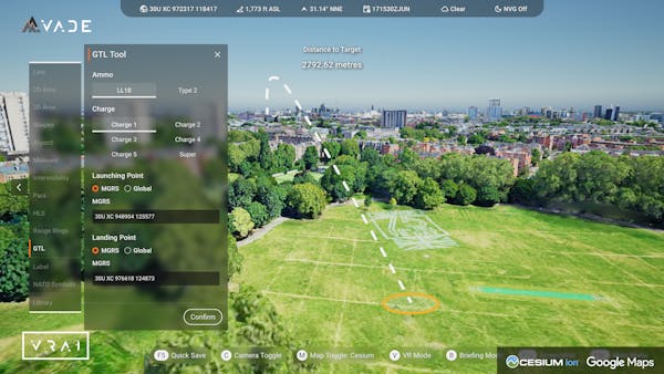
Gun target line (GTL) tool. Courtesy VRAI.

GTL and impact of explosives. Courtesy VRAI.
VADE employs Cesium World Terrain and Bing Maps Aerial imagery with Cesium for Unreal to enable users to navigate to places that matter for their missions, manipulating the time of day and simulating weather conditions, with high-fidelity rendering. When users are online, they can pull in Google Photorealistic 3D Tiles for exercises in urban areas, and Vexcel data is a boon when VADE is used as part of an airgapped solution via Cesium ion Self-Hosted.
The VADE library includes data via Cesium ion; 3D models of aircraft, tanks, and other vehicles; NATO map marking symbols for friendly forces and enemy capabilities; and user-specific sources, like their own imagery, photogrammetry, or GitHub repos. VADE connects to users’ private Cesium ion accounts for hosting, tiling, and streaming efficiently. Using geospecific data via Cesium saves VRAI engineers and their users days of work per location and obviates the need for hand modeling or geotypical data, improving situational awareness and decision speed and reducing the cognitive burden on those tasked with complex planning and rehearsal.
“It’s a transformative way of planning for defense. We operate in multiple dimensions—why wouldn’t we plan in multiple dimensions?” said Ant Casson, former Squadron Commander in the Royal Air Force and VRAI’s business development lead for the UK and Europe. “The possibilities are endless for VADE, enabled by the powerful tools provided by Cesium for Unreal.”
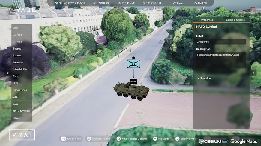
The VADE library includes 3D models of aircraft, tanks, and other vehicles. Courtesy VRAI.
VADE is dual use: in addition to its defense value, the app’s live 3D COP enables better decisions with real data for emergency services, disaster relief, critical national infrastructure planning, large event planning, and agricultural monitoring.
Learn to integrate 3D geospatial data when clarity, confidence, and speed matter most.