Cesium at I/ITSEC 2024
Join Cesium at the Interservice/Industry Training, Simulation, and Education Conference (I/ITSEC) in Orlando, Florida, from December 2-5! I/ITSEC is the world’s largest gathering of professionals in modeling, simulation, and training, and we’re excited to be a part of it once again.
Stop by BOOTH 221 for Cesium demos curated specifically for the modeling, simulation, and training community.

Connect with Cesium Experts
I/ITSEC is a great opportunity to engage directly with our leadership and engineering teams. We look forward to the opportunity to answer your questions and demonstrate the latest capabilities from Cesium.
We will also be hosting a Cesium Happy Hour at our booth on Tuesday from 3-5PM.
Get Hands-on with Cesium ion Self-Hosted
Announced last year at I/ITSEC, Cesium ion Self Hosted provides an offline capability for hosting, tiling, and streaming massive heterogeneous 3D geospatial datasets. When Cesium customers need to move their solution to the high side or a disconnected environment, Cesium ion Self-Hosted is the way to go.
At I/ITSEC this year, we will feature a dedicated station where you can get hands-on experience with Cesium ion Self-Hosted. Like what you see and want to try it out in your environment? You can sign up for a free 30-day evaluation of Cesium ion Self-Hosted right at the booth.
We’ll also have all the Cesium Global 3D Content offline locally in our booth. This is the same data we ship to our Cesium ion Self-Hosted customers for hosting in their own local environment.
Interact with these datasets in a Cesium Story hosted locally by Cesium ion Self-Hosted.

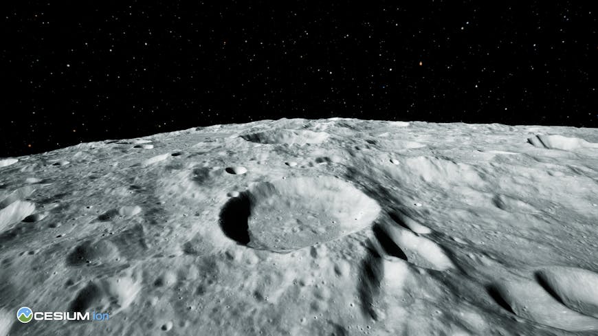
Cesium Moon Terrain: the first complete, accurate, and readily-accessible 3D dataset of the moon.
Cesium World Bathymetry: a global bathymetry and topographic terrain tileset that enables 3D visualizations, simulations, and analytics for use cases like oil and gas exploration, navigation for unmanned undersea vehicles (UUVs), managing offshore wind farms, and analyzing essential climate science.
Japan 3D Buildings and Regional Terrain Data: Providing a foundation for building digital twin applications and solutions in Japan.
Vexcel 3D Cities: High-quality 3D data models for more than 60 metro areas across the globe available for offline use with Cesium ion Self-Hosted.

Cesium Moon Terrain

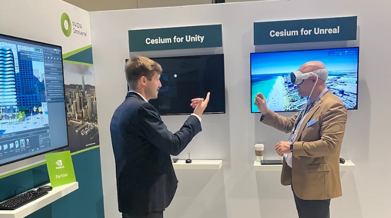
- Cesium for Unreal - Integrated with Unreal Engine Editor, Actors and Components, Blueprints, and other UE features to enable a high degree of interactivity, physical realism, and photorealism to create amazing experiences.
- Cesium for Unity - Cesium for Unity is tightly integrated with Unity making it possible to visualize and interact with real-world content in editor and at runtime. The plugin also has support for Unity game objects, physics, collisions, and character interaction.
- Cesium for Omniverse - Cesium for Omniverse enables users to visualize and interact with a full-scale, high fidelity WGS84 globe within NVIDIA Omniverse to create, visualize, and analyze simulations in their precise 3D geospatial context.
- Cesium Native - Cesium Native powers Cesium's runtime integrations and is an open source foundational layer for any 3D geospatial software, especially those that want to stream 3D Tiles.
A First Look at Cesium’s all new Design Tiler
To improve workflows and capabilities that place architecture, engineering, construction, and operations (AECO) content in a 3D geospatial context, Cesium has developed a new Design Tiler and Revit Add-In, now available for early access and feedback via our AECO Tech Preview Program.
These tools transform IFC (Industry Foundation Classes) and Revit files into 3D Tiles, the OGC community standard created by Cesium for streaming massive 3D geospatial datasets
CesiumJS Example with One World Terrain’s Well Formed Format based on 3D Tiles:
The past year has seen many great developments for 3D Tiles, including its use by NBC Sports for broadcast coverage of the Paris Summer Games.
At I/ITSEC, we will be showing how we continue to evolve this OGC Community Standard developed by Cesium including specific enhancements that are part of the U.S. Army’s One World Terrain Contract. Stop by our booth to see live demos of new features in the One World Terrain Well Formed Format (WFF), an extension of 3D Tiles.
Once again Cesium will bring partners into the booth to showcase how they are utilizing the Cesium Platform. Stay tuned for specific days and times these demos will be shown.
- Air Force Research Lab (AFRL), Gaming Research Integration Learning Laboratory (GRILL) - Presenting Glimmer, a VR application with Cesium Moon Terrain. (Wed. 1:30-6 pm; Thurs. 9:30 am- 3 pm)
- Battle Road - Presenting AtomEngine, an Earth-scale realtime multiplayer simulation using Cesium World Terrain as well as their custom Cesium for Godot integration. (Tues. noon-6:30 pm; Wed. 9:30 am-1:30 pm)
- Reveal - Presenting Farsight, a mobile first platform providing surveillance video, 2D, and 3D geospatial data for use in decentralized, comms-limited environments. (Tues. 2-6:30 pm; Wed. 1-30-6 pm)
- Brightline Interactive - Presenting SpatialCore, Leveraging USD to bring AI to 3D environments with Cesium geospatial context. (Mon. 2-6 pm; Tues. noon-2 pm)
- LuxCarta - Presenting BrightEarth, a web service that uses AI-enhanced production techniques offering high resolution building and tree extraction from from a range of sub-meter imagery sources rendered with CesiumJS. (Mon. 2-6 pm; Wed. 9:30 am-1:30 pm)
- Northrop Grumman - presenting Helix, which uses Cesium for Omniverse to visualize generated synthetic training data. (Thurs. 9:30 am-3 pm)
Stop by BOOTH 221 or reach out to schedule time with the team. We look forward to connecting with you in Orlando!