Introducing Cesium World Bathymetry
We’re delighted to announce Cesium World Bathymetry, a new global tileset that opens up visualization and analysis of underwater environments. Cesium World Bathymetry enables exciting and wide-ranging 3D visualizations and simulations for use cases like oil and gas exploration, navigation by unmanned undersea vehicles (UUVs), managing offshore wind farms, and analyzing essential climate science.
Cesium World Bathymetry
Cesium World Bathymetry includes land terrain for exploring coastal areas, complementing Cesium World Terrain’s global land terrain coverage. It fuses multiple open data sources into a single bathymetry and topographic terrain tileset, including GEBCO's global dataset and incorporating higher resolution data around the world up to 1m resolution.
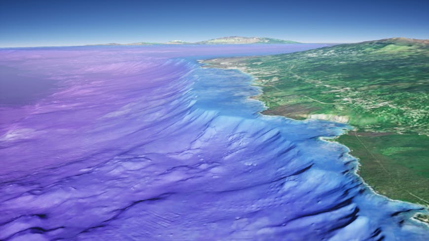
Hawaii coastline in Cesium World Bathymetry
Cesium World Bathymetry is easy to access and use. Just sign into Cesium ion SaaS, add Cesium World Bathymetry to My Assets, and begin streaming into CesiumJS, Cesium for Unreal, Cesium for Unity, Cesium for Omniverse, and other 3D engines. To stream from your own environment, Cesium World Bathymetry can also be licensed with Cesium ion Self-Hosted.
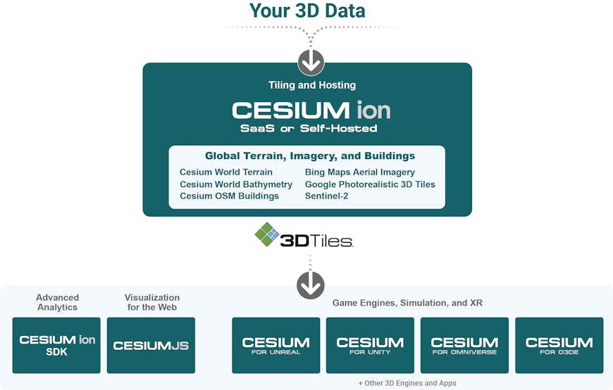
The Cesium platform
The following clip illustrates several CesiumJS options useful for bathymetry visualization.
Bathymetry off the coast of the Philippines, visualized with CesiumJS
This is just the beginning! In the coming months, look for enhancements to CesiumJS, Cesium for Unreal, Cesium for Unity, and Cesium for Omniverse that make it easier to build visually stunning apps. We also plan to include additional high-resolution data for areas of particular interest around the globe.
If you have feedback or requests, or are interested in hosting Cesium World Bathymetry in your own environment, Contact us.
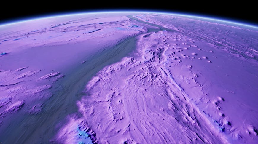
The Mariana Trench in Cesium World Bathymetry