X3DOM Now Supports 3D Tiles
X3DOM developers can now stream and visualize large 3D Tiles datasets directly within declarative X3D scenes. The capability was developed by the Web3D Consortium through a Cesium Ecosystem Grant, expanding interoperability between two open standards for web-based 3D geospatial applications.
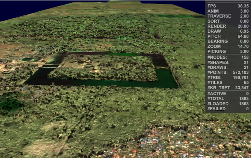
Stream massive geospatial datasets in X3DOM with 3D Tiles, as with this view of Angkor Wat, Planet Labs Open Data, CC-BY 4.0. Courtesy Andreas Plesch.
X3D is an open standard for representing interactive 3D scenes, including applications in visualization, simulation, and digital twins. With 3D Tiles support in X3DOM, developers can bring heterogeneous geospatial datasets, such as buildings, terrain, photogrammetry, and point clouds, into X3D applications while taking advantage of X3D's mature, interactive and declarative authoring model.
The Web3D Consortium received a Cesium Ecosystem Grant in August 2025 to advance support for 3D Tiles, an Open Geospatial Consortium community standard, in X3D formats. The completed implementation introduces core 3D Tiles 1.1 functionality to X3DOM and includes test datasets, code repositories, demos and educational materials to help developers explore the new functionality.
This project was led by Anita Havele, Executive Director of the Web3D Consortium. The technical lead was Andreas Plesch, EarthStruct LLC, who presented their progress on October 14 at the Web3D 2026 Conference in Doha, Qatar. Read more about the work in the Web3D article: OGC 3D Tiles in X3DOM.
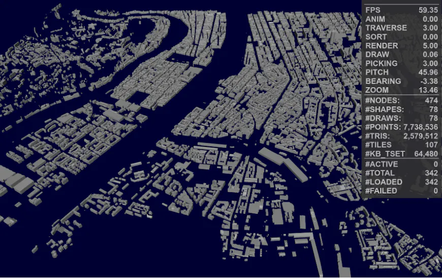
3D Tiles are now supported in X3DOM. Here a Lyon GIS dataset, with >7 million points, is streamed in X3DOM with 3D Tiles. Courtesy Andreas Plesch.
By aligning open standards, this work increases interoperability and expands deployment options for 3D geospatial content. Every new implementation of 3D Tiles increases the value of open geospatial data pipelines. Developers gain more deployment options, organizations gain greater flexibility, and users benefit from access to rich 3D geospatial experiences across more environments.
Have an open-source project that could expand access to 3D Tiles or improve interoperability across the 3D geospatial ecosystem? Learn more about Cesium Ecosystem Grants.