Drip Visual's PublicTwin Enables Public Participation in Urban Planning with Cesium
Recent legislation in the Netherlands requires public participation as part of the permit process for urban planning. Drip visual’s PublicTwin is an online platform enabling citizen input with Photorealistic 3D Tiles and Cesium for Unreal.
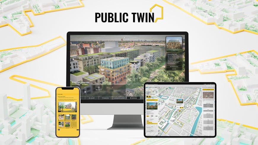
PublicTwin empowers citizens to explore and voice opinions about proposed changes to their neighborhoods. It includes a simplified overview, a Cesium-powered digital twin upon zooming in, and a participatory questionnaire. Courtesy drip visual.
Founded in 2021, drip visual combines AEC, gamification, and geospatial data to democratize urban planning, using real-time engines as communication tools. Needing to attend in-person meetings at specific times and interpret 2D schematics or overly simplified 3D displays pose barriers to public understanding and participation in permit processes. Drip visual’s PublicTwin geospecific representation is available online, empowering citizens to explore and voice opinions about proposed changes to their neighborhoods.
Drip visual launched its PublicTwin Pilot Program in June 2024 at Provada, a real estate conference in Amsterdam, with interactive visualizations of a Nieuw Delft master plan and a Leeuwendeel residential building proposal in the city of Delft.

Nieuw Delft master plan, aggregating multiple proposals in accurate geospatial context with Cesium. Courtesy drip visual.
Drip visual receives 3D models of proposed buildings from architects or engineers, edits the models as needed, and exports them to Unreal Engine for high-fidelity rendering and integration with accurate geospatial context and lighting via the Cesium for Unreal plugin.
The team employs Google Photorealistic 3D Tiles accessed from Cesium ion for accurate, easily identifiable surroundings for urban planning and AEC. Rather than seeing a nondescript building on the corner, citizens recognize, for example, the local train station, complete with windows and signage they encounter in the real world. Designed for citywide scale and down to city blocks, Photorealistic 3D Tiles use the Open Geospatial Consortium (OGC) community standard 3D Tiles format, created by Cesium, to efficiently stream massive amounts of data and immerse users in the environment. PublicTwin is accessible on the web via pixel streaming.
“Photorealistic wider city context generation was a challenge, and the ability to utilize Cesium directly within Unreal Engine 5 to stream Google Photorealistic 3D Tiles allowed us to achieve good results more efficiently, instead of manually modeling a city,” explained the drip visual team. Documentation and tutorials in the Learning Center helped the studio prototype quickly, they said.

Users can zoom in on a Leeuwendeel residential building proposal in the city of Delft. Courtesy drip visual.
Drip visual is encouraging municipalities, developers, and architects to join its Pilot Program. Currently in its alpha stage, PublicTwin is used for individual projects, but the team is working with early adopters on its vision, including expanding the tool to be a broadly available SaaS platform.
Learn how Cesium increases public participation and saves time for AEC projects.