Cesium Brings Context and Flexibility to Nearmap's 3D Cities
We’re partnering with our friends at Nearmap to visualize their extraordinarily wide-scale 3D photogrammetry models. Nearmap’s high resolution datasets cover urban areas across Australia, New Zealand, and the United States. With their 3D Viewer built on CesiumJS, that data is easily accessible for applications ranging from urban planning to telecommunications.

Nearmap’s 3D city model of Boston, visualized in CesiumJS and combined with global terrain from Cesium ion. Their data covers 78 urban areas in the United States.
High res 3D city models
Nearmap takes high resolution photographs using multi-angled, proprietary camera equipment carried on light aircraft. They then stitch those images together to construct 3D models. They’ve captured and processed tens of thousands of square miles of the most densely populated areas in Australia and the United States, and their 3D models include the areas where the majority of those populations live and work. These models remain current with frequent updates.
New York City. Nearmap has collected years of data, making it possible to measure change over time, such as for solar panels, pools, or roofs.
Streaming with Cesium and 3D Tiles
Nearmap has been collecting data for over a decade, but only with their new 3D Viewer have they been able to instantly stream their 3D content at massive scale.
Nearmap’s 3D Viewer allows users to visualize cities in 3D on a CesiumJS globe. Using Cesium ion gives Nearmap’s city datasets geospatial context as they combine their city data with our global curated terrain data.
The app also offers measurement tools, such as checking the height of a tower, the pitch of a hill, or the area of a lot.
Flexible exporting
For those who want to use Nearmap’s data in their own custom applications, Nearmap offers their data for download. Their 3D Export tool allows users to immediately export a custom area in a variety of formats, including as 3D Tiles.
Nearmap was an early adopter of the 3D Tiles open standard. 3D Tiles make it possible to view their data covering thousands of square miles, even at the high resolutions Nearmap collects. Since 3D Tiles is an open standard, users can integrate Nearmap’s 3D maps into custom applications.
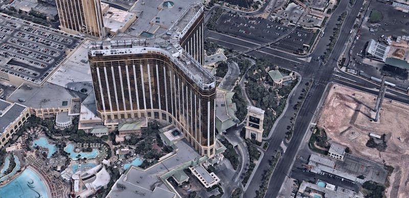
Users who need to export Nearmap’s data, such as this Las Vegas dataset, have the flexibility to select however many square kilometers they need.
Numerous applications
Numerous applications take advantage of Nearmap’s 3D city data, from emergency response planning to urban planning to 5G network rollouts. Users remotely inspect work sites, evaluate properties and infrastructural assets, and evaluate building development over time. With Cesium and 3D Tiles, users have better access to that data.
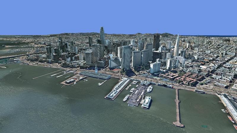
San Francisco. With over 99,000 square miles of coverage, Nearmap’s datasets are used for public safety, utilities, telecom, real estate, and infrastructure applications.
The open standards at the core of Cesium give our community the flexibility to get the most out of their geospatial data. No matter what type of data you have, Cesium can help you easily view, combine with other datasets, and share it. Try it out by signing up for a free ion community account.