Uch Enmek Provides a Virtual Exploration of the Uch Enmek Ethno-Nature Park in Siberia
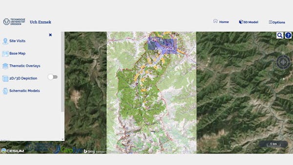
The Altai Mountains in Siberia, Russia, boast an outstanding cultural heritage and many prehistoric structures. Relics of the nomadic Scythian culture, which flourished 2,500 years ago, ranks high among these archaeological treasures. They can be found at various burial sites in the Altai. Scythian burial sites often contain precious artifacts and bodies that have often been well-preserved due to the underground permafrost conditions. Some of the most famous underground burial chambers, called kurgans, are located in the Karakol and Ursul Valley close to the mouth of River Karakol. In 2001 the Altai Republic government designated the Uch Enmek Ethno-Nature Park a conservation area.
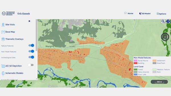
The Uch Enmek web application contributes to awareness, information, and appreciation of Uch Enmek. It comprises maps, satellite imagery, and model structures that have been created, interpreted, and compiled over many years of geo-scientific activities of the Institute of Cartography in the Altai. The archaeological inventory data shown in the overview map was contributed by archaeologists J. Bourgeois and his team of Ghent University.
Built on Cesium, the application follows an open concept with a clear path to ingest further documents in the future. The application also provides a way for visitors to edit the content.
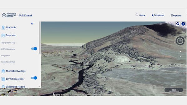
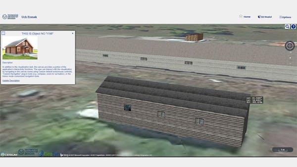
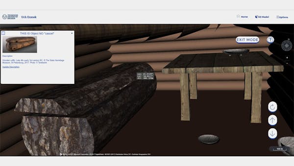
The “Options” switch allows zooming into higher detail, currently offered for the Tuekta and the Karakol sites. For the base map, users can choose imagery provided by Bing or by the Ikonos sensor, as well as OpenStreet Map data to provide context. More specific GIS layers can be draped over the selected base. Moreover, by choosing “3D depiction,” users can view the Tuekta and the Karakol sites in 3D mode using customized 3D terrain sources. Users can also use the “Schematic Model” controls to explore a 3D model of the kurgan underground burial chamber. The 3D glTF features and nodes, including houses, furniture, and tombs, are linked to a database where the associated descriptive information is stored.