Ansys Uses Cesium ion Self-Hosted for Geospatial Data Cloud
With Ansys Systems Tool Kit (STK), engineers model land, sea, air, and space scenarios to understand the relationships among vehicles, payloads, facilities, and environments, including terrain. Ansys Geospatial Data Cloud (GDC) integrates Cesium ion Self-Hosted and global 3D content to provide STK with out-of-the-box access to accurate geospatial context within its time-dynamic simulations.
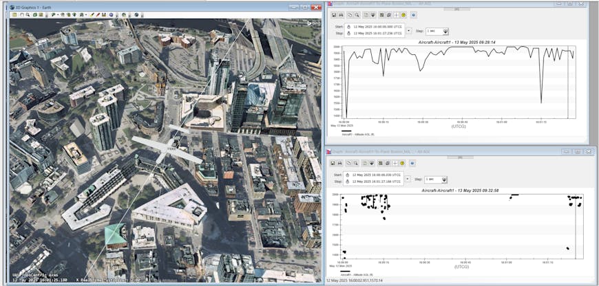
UAV over Boston in Ansys STK, with Geospatial Data Cloud using Cesium ion Self-Hosted. Courtesy Ansys.
STK was released in 1989 to serve US and allied aerospace and defense organizations, and GDC will be available to STK users in July 2025. Users may create virtual worlds including buildings, terrain, and other physical structures. Subsequently, an infinite number of simulation configurations may be exercised, resulting in a significant reduction in the dependence on physical prototypes.
Using Cesium, GDC will replace Ansys’ Geospatial Content Server, removing the need to develop and maintain their own real-world data, tilers, and hosting solution.
“Being able to use Cesium ion Self-Hosted has saved a significant number of man hours that can be redirected towards additional ways to take advantage of the unprecedented access to data. We estimate the time savings to be the equivalent of half a full-time employee,” the Ansys team noted.
Cesium has helped Ansys enhance mission modeling since 2011.
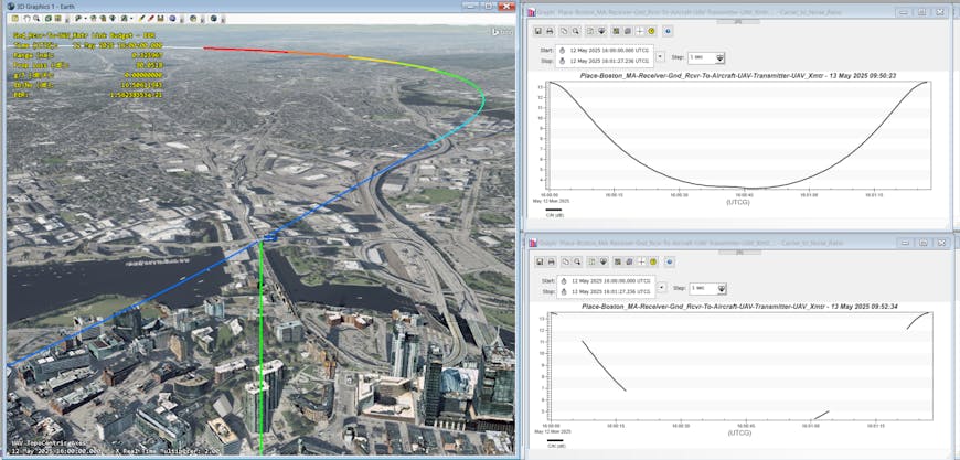
Communication signal to noise over Boston in Ansys STK, with Geospatial Data Cloud using Cesium ion Self Hosted. Courtesy Ansys.
Cesium ion Self-Hosted provides hosting, tiling, and streaming for massive heterogeneous 3D geospatial datasets in users’ own clouds, data centers, or edge devices, enabling air-gapped solutions that meet strict security requirements and can be deployed to remote, disconnected environments.
GDC accesses Cesium World Terrain, Cesium World Bathymetry, Cesium OSM Buildings, Japan 3D Buildings and Terrain, and Cesium Moon Terrain via Cesium ion Self-Hosted. Accurate elevation data, depth data, and per-building metadata support planning and analysis in critical simulations. Cesium OSM Buildings are streamed as 3D Tiles in conjunction with Cesium World Terrain or Cesium World Bathymetry. Users can add their own datasets to be tiled into 3D Tiles for optimal streaming and visualization in STK.
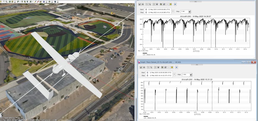
UAV flying low over Boston in Ansys STK, with Geospatial Data Cloud using Cesium ion Self-Hosted.
Real-world data enables clearer pictures for analysis and decisions in complex multidomain scenarios.
Create and host 3D content in your own environment with Cesium ion Self-Hosted, and visit Ansys in the Cesium booth at GEOINT Symposium, #2231, to see Geospatial Data Cloud in action.
Hear from Ansys at the 2025 Cesium Developer Conference. Register to join us in Philadelphia in June.