Cesium Research's Universal Navigation Interface to Civilization (UNICiv) Accepted for Publication and Presentation at Eurographics Conference
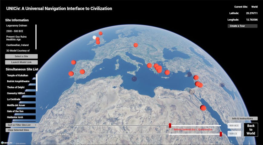
Globe view of UNICiv, showing sites from 1800 BCE - 1500 CE. The Legananny Dolmen in Ireland is selected.
Interactive digital maps display detailed contemporary geographic information, increasingly in 3D, for navigation, exploration, and virtual travel. What the world looked like near the beginnings of human civilization, however, is more difficult to discover, search, and visualize. Cesium Research’s most recent publication, UNICiv: A Universal Navigation Interface to Civilization, explores Cesium’s ability to support 3D models of ancient and historic sites within their geographical and temporal context.
Developed over the summer by Cesium's Yuhan Liu and led by Dr. Norman Badler, Head of Research, UNICiv is an extensible, universal, spatio-temporal interface that leverages Cesium for Unreal and 3D Tiles to visualize structures of the distant past. As a demonstration and education tool, UNICiv’s applications range from cultural heritage to urban planning. The UNICiv publication has been accepted as a full research paper to the Eurographics Workshop on Graphics and Cultural Heritage (GCH 2024).
GCH is the premier technical meeting for novel digital technologies in the cultural heritage domain, fostering discussions in AI, Computer Graphics, Computer Vision, and Human-Computer Interaction.
UNICiv offers over 30 explorable 3D models of historic and archaeological sites around the world, displayed collectively on a single interactive globe. These models are produced by archaeologists, independent artists, or research projects from institutions and nonprofits. Sites range in time from 8000 BCE to 1500 CE. Examples include Neolithic monuments like Stonehenge, ruins of Bronze Age villages, and Greco-Roman temples. These models have been curated and imported into Cesium for Unreal through Cesium’s integration with Sketchfab. The models are imported into Unreal using Cesium’s plugin and placed on top of Cesium World Terrain with Bing Maps Aerial imagery.
Users can explore the past in 3D using UNICiv’s interface. Start by navigating a Cesium globe where ancient structures are highlighted as pins. The timeline interface indexes sites that appear on the globe. When users select a site, they are taken on a flight path to its geolocated model, where they can use traditional game controls to explore. Users can build their personalized list of sites to save, compare, and present their findings. Additionally, some locations offer reconstructed visualizations that can be overlaid on current-day ruins, providing a unique perspective on how these ancient sites once appeared.
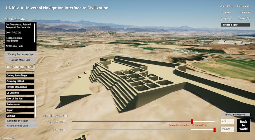
Perspective view of the reconstructed Old Temple at Pachacamac in Peru. Site list controls set to Common Era (0-1500 CE). Cesium World Terrain shows the present-day view of the Lima Province. Model courtesy of Aline Normoyle, Clark Erickson, and Norman Badler, used with permission.
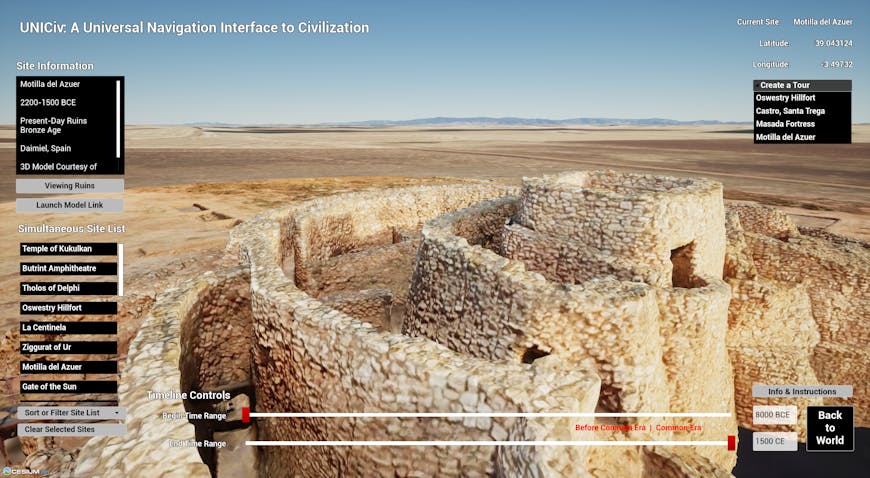
La Motilla del Azuer, 3D Model from Global Digital Heritage on SketchFab. Tour site list shows manually added fortification sites.
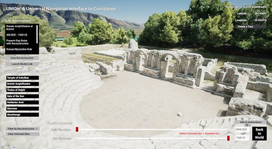
Amphitheatre of Butrint, 3D Model by Ørjan Sandland, imported from Sketchfab (CC Attribution). Simultaneous Site List shows all sites with reconstructions (not pictured) available to view. The Albanian mountains are part of Cesium World Terrain with Bing Maps Aerial Imagery.
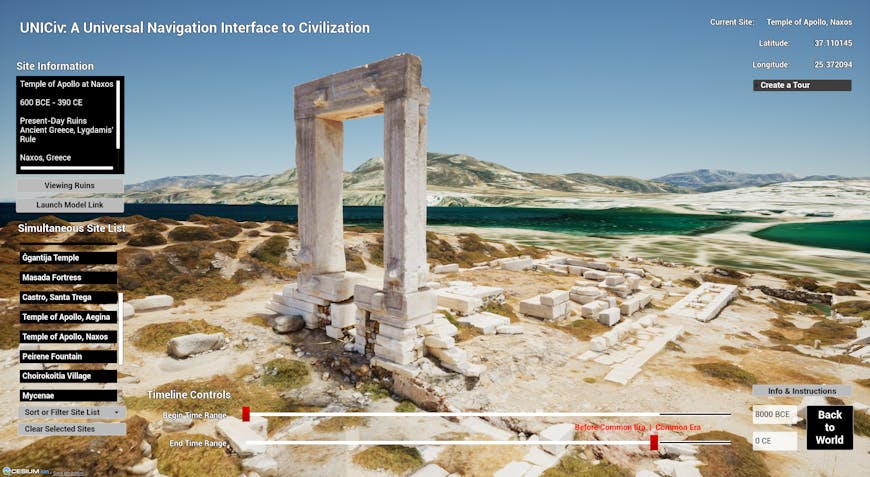
Temple of Apollo - Naxos Greece, 3D Model by Vasilis Haroupas on SketchFab. Simultaneous Site List shows all available BCE models. Terrain from Cesium World Terrain with Bing Maps Aerial Imagery.
From incorporating more models to iterating on user experience, UNICiv is an ongoing research project with exciting directions for future work. A significant task for the future would be to incorporate and reverse-engineer significant geographical changes to experience the natural environment experienced by the earth’s earliest inhabitants. In the meantime, UNICiv provides a uniform, 3D geospatial, contextualized interface to the re-discovered past.
The UNICiv publication was one of eight full research papers accepted to the 22nd Eurographics Workshop on Graphics and Cultural Heritage 2024. The Cesium research team is excited to present at the conference, which takes place September 16–18, 2024, in Darmstadt, Germany.
UNICiv is a powerful tool for visualizing temporal change on a global scale, especially in cultural and historical preservation. Initial user evaluations have highlighted UNICiv’s significant potential for advancing archaeological demonstration, education, and exploration. Furthermore, the UNICiv interface becomes increasingly adept at capturing the development of human civilization as more 3D models are integrated into it. Thus, the Cesium research team plans to soon provide open access to the UNICiv resource and welcomes collaborations and user contributions. Contact Dr. Norm Badler to express your interest in UNICiv.
For help getting started on your own project with Cesium for Unreal, visit the Learning Center.