Cesium World Terrain Adds 1m Resolution in Areas Across US
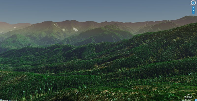
The Great Smoky Mountains
Our mission to bring you higher resolution curated terrain in Cesium ion continues! We’ve curated additional 1-meter resolution terrain data across various parts of the US and incorporated it into Cesium World Terrain.
Besides more accurate visualizations, the increased resolution of Cesium World Terrain brings more precise line and area measurements, visibility analysis, building placement on terrain, and more use cases beyond visualization. Just as before, users can fuse Cesium World Terrain with higher resolution terrain uploaded to Cesium ion.
Cesium ion users have been upgraded to the new tileset so they will be able to immediately take advantage of better visual quality and more accurate analysis in their apps.
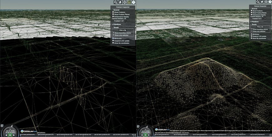
Improved terrain in Long Island, NY. The denser mesh (right) in this wireframe view highlights how dramatically the resolution has improved.
The increased resolution terrain includes major cities, which will greatly improve accuracy of analysis in these urban areas. Some of the cities that have been improved are Boston, New York, Philadelphia, Washington DC, Richmond, Nashville, Denver, Santa Fe, Salt Lake City and Los Angeles.
The improved resolution in areas like the Adirondacks, the Front Range, and the Great Smoky Mountains provide incredible views.
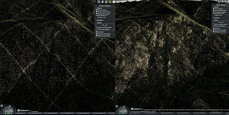
Improved terrain in the Pecos Wilderness in the Santa Fe National Forest.
We also added enhancements to CesiumJS 1.52 to make initial Cesium World Terrain loading faster. To take full advantage of the higher resolution data, you will need to use CesiumJS 1.52 or higher. Previous versions will still work, but the highest level terrain may not always be used.
Sign up for your Cesium ion account here to start exploring the new Cesium World Terrain.