Browse Historical Images of the 1941 Attack on Pearl Harbor with Pearl Harbor Archive
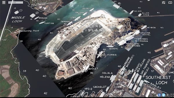
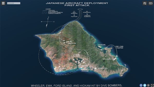
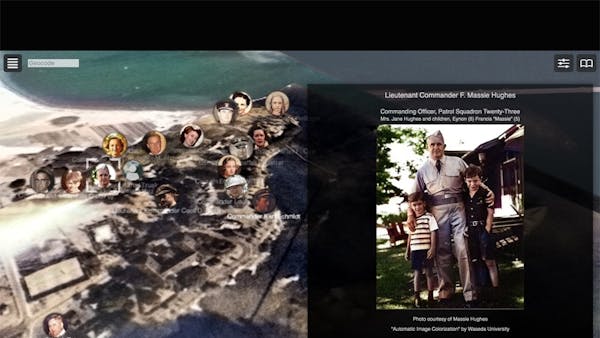
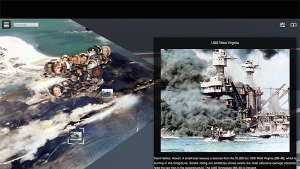
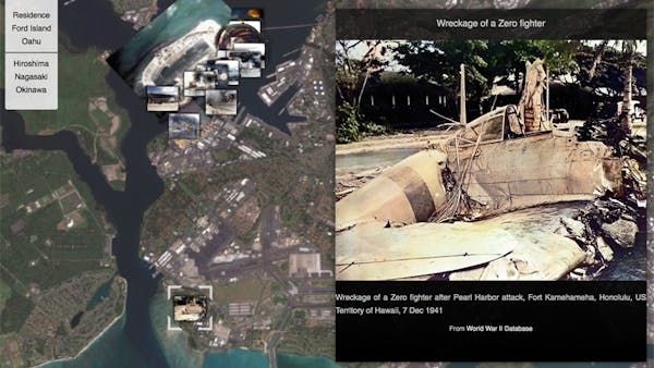
The Pearl Harbor Archive, developed by Hidenori Watanave’s team at Tokyo Metropolitan University, is a layered map with details about the 1941 Japanese bombing of Pearl Harbor, including locations and historical images of ships, the hand-drawn Japanese map of the island, and quotations from eyewitness accounts. This content is based on Katrina Luksovsky’s book Ford Island December 7, 1941 and the public domain material of the US Navy. Users can browse the face photographs and testimony of the soldiers and their families staying in Ford Island, the attack course of the Japan Imperial Navy, and the US Navy warships located in Pearl Harbor.
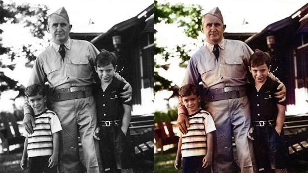
The original photos and aerial photos are black-and-white photographs, but they were colored using the Automatic Image Colorization service developed by Waseda University and presented at SIGGRAPH 2016 in “Let there be Color!,” by Satoshi Iizuka, Edgar Simo-Serra, and Hiroshi Ishikawa. Black and white photos will be automatically colored by hovering or touching.