Visualize 5-20cm Imagery and Terrain with FodarEarth™
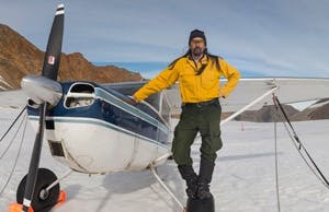
Over the past 20 years, Dr. Matt Nolan, a research professor at University of Alaska Fairbanks, has been researching and designing new methods of capturing topography and imagery. The result is Fodar, a cost-effective technology able to capture resolutions of 5-20cm.
Fairbanks Fodar, Dr Nolan’s company, ported FodarEarth from Skyline to Cesium in order to provide their clients with access to their projects without having to install any additional software or browser plugins.
Technology
At a resolution of 10cm, Fodar generates point clouds that are approximately 7GB per square kilometer. To allow Fairbanks’ clients to view their projects at any desired detail level, FodarEarth uses Cesium’s level of detail for serving imagery and topography at various zoom levels up to 5cm resolutions (level 24).
FodarEarth relies on three separately hosted services to seamlessly provide imagery and terrain to the browser. Bing Maps provides the basemap imagery, Amazon’s S3 service hosts the high-resolution imagery generated by Fodar as a Tile Map Service (TMS), and AGI’s STK Terrain Server both pre-processes the high-resolution DEMs into optimized meshes and hosts the data for use within the application.
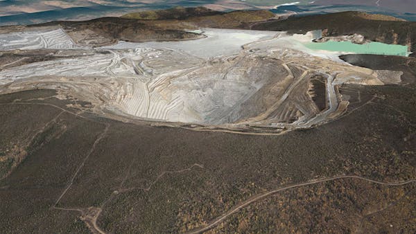
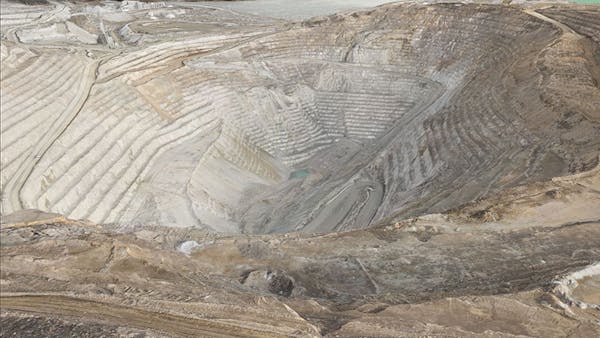
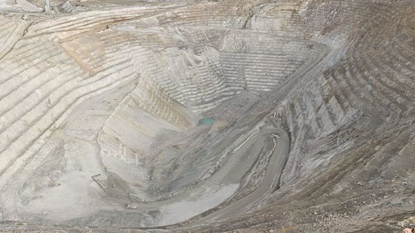
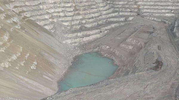
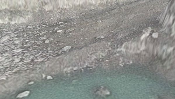
Ft Knox Gold Mine
Ft Knox Gold Mine is a great example of the detail Fodar captures. As we zoom into the mine, we start to see the rocks and boulders not just as images, but as terrain features.
What’s next
With a semi-regular capturing of Fodar data over a particular location, it’s possible to create accurate differential models of changes in terrain over time. Dr Nolan has been using this technology to track the effects of climate change on the fragile Alaskan terrain, which in many places is held together by glaciers.