High performance
Processes massive datasets. Produces tilesets formatted as a mesh that is efficient to visualize and that avoids the expensive runtime conversions required by traditional heightmaps.
When tiling terrain with Cesium, combine datasets to create a unified tileset optimized for fast streaming to global-scale 3D apps.
Processes massive datasets. Produces tilesets formatted as a mesh that is efficient to visualize and that avoids the expensive runtime conversions required by traditional heightmaps.
Processes global-scale high resolution datasets in any input format supported by GDAL and in any projection. Automatically reprojects data into WGS84 (EPSG:4326).
Just upload your data and point your apps at Cesium ion. Also available for self-hosted deployment.
Supports standard formats including USGS ASCII DEM (.dem), GeoTIFF (.tiff, .tif), and Cesium Terrain Database (.terraindb)
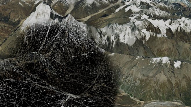
Peek at the underlying irregular mesh with dynamic resolution.
Mosaicking allows you to bring together various terrain data sources in different formats into a unified tileset.
Preserve your highest-resolution data with irregular mesh geometry. This allows merging different resolutions without upsampling to the maximum resolution.
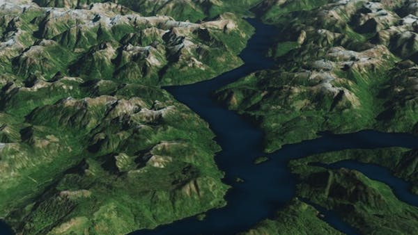
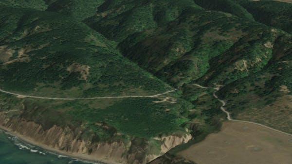
Tiles loading a higher level of detail.
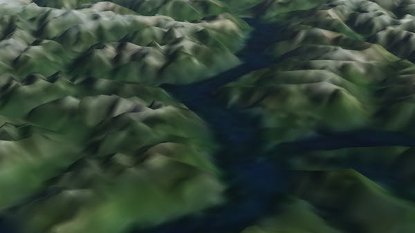
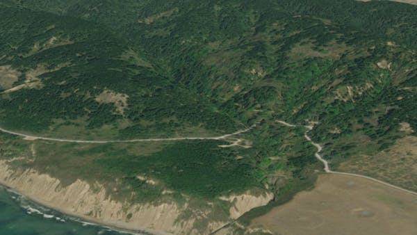
Tiles showing a lower level of detail.
Hierarchical level of detail tiles are generated for smooth streaming and optimal load times in CesiumJS. Simplified meshes are loaded when viewed from far away, and higher resolution tiles seamlessly replace lower resolution ones as needed.
The precisely computed geometric error captures the visual accuracy of the simplified mesh and allows it to be shown only at distances when there is no discernible difference.
The terrain tiler achieves far better compression rates than general purpose algorithms like gzip, without any sacrifice of precision. Decoding in CesiumJS is fast and makes use of GPU acceleration and web workers for parallel speedup.
Terrain with shadows and lighting enabled.
Terrain without shadows and lighting enabled.
The terrain tiler can optionally compute the additional attributes needed to create water and terrain lighting effects at visualization time.
These add visual realism and are treated as extensions, allowing you to pick and choose the visual features needed for your application, and leading to more compact tile requests.
If your enterprise deployment requires the 3D Tiling Pipeline in your environment, let's talk.