Add Real-World Context to 3ds Max Models with the Cesium ion Plugin
Whether you’re sketching out plans for a new highway or designing the smart cities of the future, we know how valuable it is to be able to see your work within an accurate geospatial context. The problem is that this type of data isn’t always readily usable with CAD models, which is why we’re excited to announce a new Cesium ion integration with 3ds Max. This integration it easy to export your models to Cesium ion where you can fuse them with globally curated 3D terrain and satellite imagery.
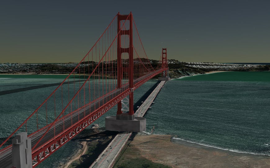
Uploading CAD models to Cesium ion is a great way to see potential designs embedded within real-world 3D data. This model is fused both with photogrammetry data of San Francisco from Vricon and the global Cesium World Terrain.
Let’s say you’re working on a new bridge proposal that you want to share with a few stakeholders for feedback. It’s much easier to get a sense of scale when you can see this model alongside the surrounding landscape and 3D buildings. With the CesiumJS library you can even set up multiple versions of the design and toggle back and forth between them.
This can be a great way to show your audience what it would look like to be standing on this bridge, or to combine your 3D content with other geospatial data like traffic congestion in the area for a more cohesive picture.
Tiling your models into 3D Tiles allows your users to interactively explore your design on the web, even for models as detailed as the Golden Gate Bridge.
When you export your model to Cesium ion it gets tiled into the 3D Tiles format. This makes sharing highly complex models over the web as easy as sharing a link. Even multi-gigabyte models can be shared on the web without losing detail since 3D Tiles makes it possible to stream in just the data needed for any given view.
Try this out for free with your own models in our 3ds Max plugin tutorial.