Cesium and FME Integration Accelerates 3D Geospatial Data Pipelines
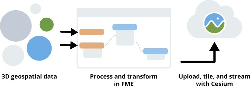
Safe Software’s FME data integration platform makes it simple to build a geospatial data workflow by transforming data between hundred of formats, connecting to external apps, and automating workflows with a graphical interface. We’ve collaborated with Safe Software to integrate Cesium and FME, bringing support for optimized streaming of many different 3D formats to the FME community by leveraging Cesium ion’s efficient and scalable 3D tiling pipeline and distributed hosting.

Process and transform your 3D geospatial data with FME, then connect via the CesiumIonConnector to the Cesium ion SaaS platform to seamlessly upload, tile, and host it for streaming into CesiumJS apps. Back in FME, use attributes of the created asset to create a customized CesiumJS application streaming from ion.

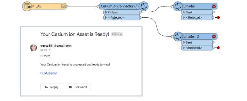
The above image shows a workflow I created in FME to automate 3D tiling point clouds. It securely uploads LAS data and launches a cloud-based tiling process in Cesium ion, optimizing it to stream efficiently by adaptively tiling and compressing.
Upon completion, FME delivers an email with the URL to a generated app, where the new point cloud tileset is streamed in CesiumJS for visualization and analysis. This workflow enables a quick way of exploring and interacting with new data that can be distributed over the web.
Check out the details about the FME and ion integration and start creating your own 3D tiling workflows.