Urban Planning Tool to Evaluate Real Estate Development Scenarios
The Denver Regional Council of Governments (DRCOG) brings together local governments to collaborate, set policy, and allocate funding in the areas of transportation and development. One of DRCOG’s many roles is to develop data, information, and visualizations that help local governments and other stakeholders understand current and predicted conditions in the region.
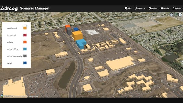
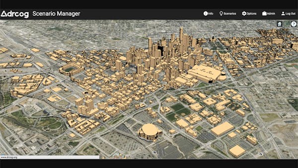
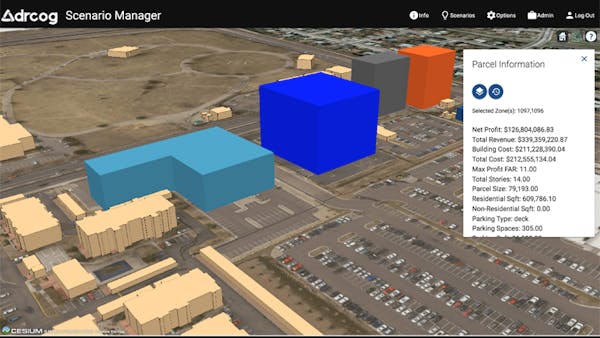
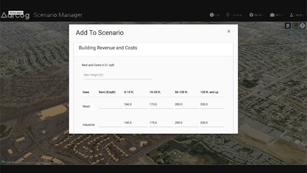
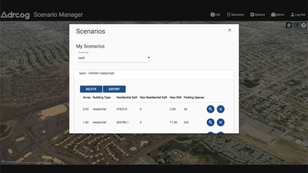
DRCOG develops and deploys a wide array of technical tools, including web-based tools to map and visualize data. DRCOG recently adopted Cesium to handle large datasets and present those datasets in an aesthetically appealing way for end users, including local and regional planners. DRCOG’s latest Cesium application is Scenario Manager, an urban planning tool that helps planners define and evaluate alternative real estate development scenarios. Cesium’s 3D mapping helps urban planners visualize the potential effects of policies and development-related decisions, such as parking requirements, building height maximums, and density requirements. Visualizing how different assumptions effect potential real estate developments, including limitations to profitability, can reveal challenges and obstacles that may lie ahead for planners, developers, and decision makers. DRCOG’s Scenario Manager also incorporates the UrbanSim API, a series of open source land use modeling tools, to help planners evaluate the profitability and scope of real estate projects. These tools help planners understand how their plans and policies influence potential private developments through a visual representation of future development scenarios and patterns.
Scenario Manager relies on large, high quality regional datasets. For example, building roofprint data is used to visualize current conditions and future scenarios. These data are the result of a unique regional data acquisition project facilitated by DRCOG and funded by nearly two dozen partners. The data were collected in a 1,100-square-mile area of the Denver region using highly accurate, high-resolution data as a source. The result is a detailed set of standardized building roofprints used for everything from preparing first responders as they arrive on a scene to impervious surface analysis to 3D modeling. The roofprints and accompanying datasets are freely downloadable and currently being updated.
![]()