Propeller Platform: Software for Drone Surveys and Inspections
The Propeller Platform creates highly accurate data visualizations from aerial imagery acquired by drones. Work sites and assets can be explored, measured, and annotated in 2D and 3D maps, as well as in point clouds and photo inspection models. Propeller Platform is used for site design and progress tracking, land surveying, remote asset inspections, and stockpile management, to name a few applications.
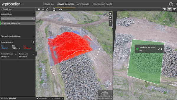
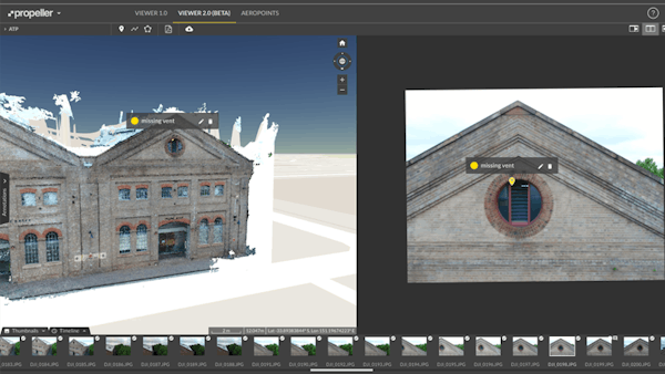
Propeller’s viewer allows side-by-side viewing and navigation of 3D map data and the original photos that the drone captured. The map is built on top of Cesium and allows rendering of the various types of 3D data generated from the photos, including orthophotos, accurate terrain, point clouds, and contours. Interactive tools allow users to measure from points, lines, areas, and volumes directly on the Cesium map. Measured quantities are visualized in Cesium using custom geometry, and the shapes used also show in the photos. This helps users understand what is actually being measured. Some of Propeller’s users capture their sites daily or weekly, so a timeline control allows them to see how their site is changing over time. There are also reporting features including output to PDF and CSV.