Skydio’s Newest Autonomous Drone Software Brings Cesium to the Field
Skydio, the unicorn startup building autonomous drones, has just released their newest product, Skydio 3D ScanTM, which brings greater autonomy to the drone market. 3D Scan simplifies drone operation, promising AI-powered flight planning that automatically creates an optimized path for data capture, as well as on-board computer vision so the drone can avoid obstacles and pick up where it left off after battery changes.
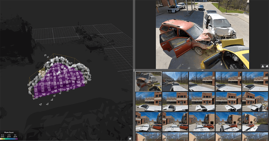
A key piece of 3D Scan is the Edge Model Viewer, a feature built on Cesium that provides an instant view of the datasets produced by 3D Scan, allowing rapid field assessments. Whereas currently drone operators have to wait until they’re back in the office to review what they captured in flight, with the Edge Model Viewer, operators can check a low-polygon 3D model on a mobile device as soon as they land the drone.
Skydio’s Edge Model Viewer allows users to see a low-polygon 3D model and their photos, all spatially indexed, as soon as they land the drone.
Quick review of a data capture drastically simplifies the workflow. That’s more nimbleness, fewer iterations, and improved captures.
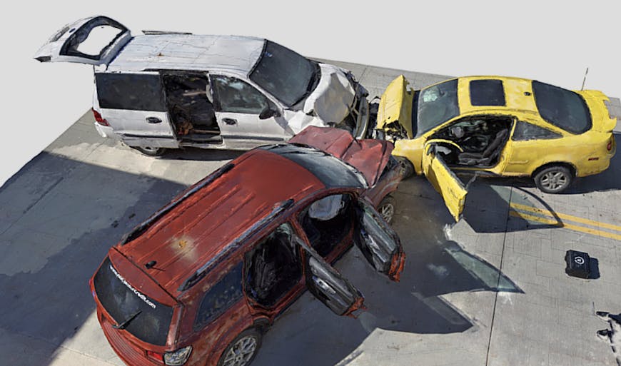
Law enforcement has only one chance to record an accident scene before cleanup begins, so seeing the data at the time of capture ensures nothing is missed.
We learned more about the Edge Model Viewer from Skydio's lead engineer for the project, Rachel Basse:
"Working with Cesium has helped us turn 3D Scan's Edge Model Viewer feature into a game-changing customer experience. Being able to view 3D models in the field, even on a mobile device, is going to make a serious difference for our customers. We look forward to changing the game for drone inspection and mapping together!"
- Rachel Basse
Autonomy Engineer, Skydio
Once satisfied with the data capture, the operator heads back to the office to download all the data from the flight, and export the photos to any photogrammetry tool. Many of those tools, including RealityCapture and ContextCapture, have integrations to Cesium ion, making it possible to view the photogrammetry data capture in 3D, together with geospatial context.
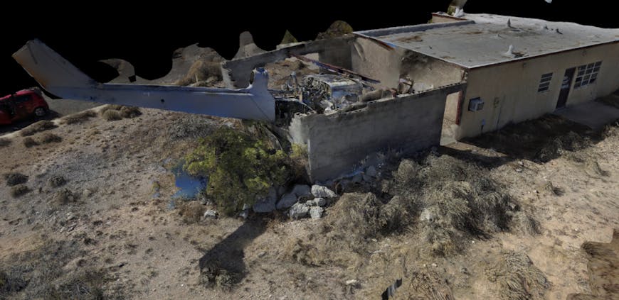
Skydio 3D Scan makes it safer and easier to fly in tight spaces like this helicopter crash site.
Making drones simpler to fly means more people will be able to successfully use them. We’re proud to be part of that success as the drone data capture visualization platform of choice. To share your own drone data online, sign up for a free Cesium ion community account.