Planning Mountaineering Routes in CesiumJS with Trailamo
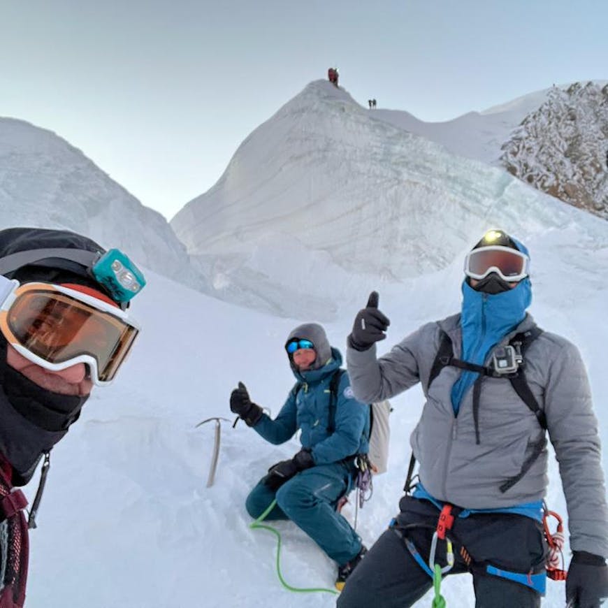
Matteo Massimi is an avid mountaineer. So when he took his most recent trip to Central Asia, there was nothing unusual about the hikes. What was new was his ability to plan the expedition in the app he created with Cesium: Trailamo.
Trailamo uses CesiumJS to bring open geospatial data to mountaineers so they can plan safer, more informed routes anywhere in the world with advanced 3D terrain analysis and layered datasets.
Trailamo is built on CesiumJS and tailored to the way an explorer like Matteo, looking for off-the-map adventures, plans outdoor experiences. With a highly precise WGS84 ellipsoid and the ability to render high-quality geospatial datasets, CesiumJS gives Trailamo a solid foundation for its sophisticated terrain analysis and numerous planning tools.
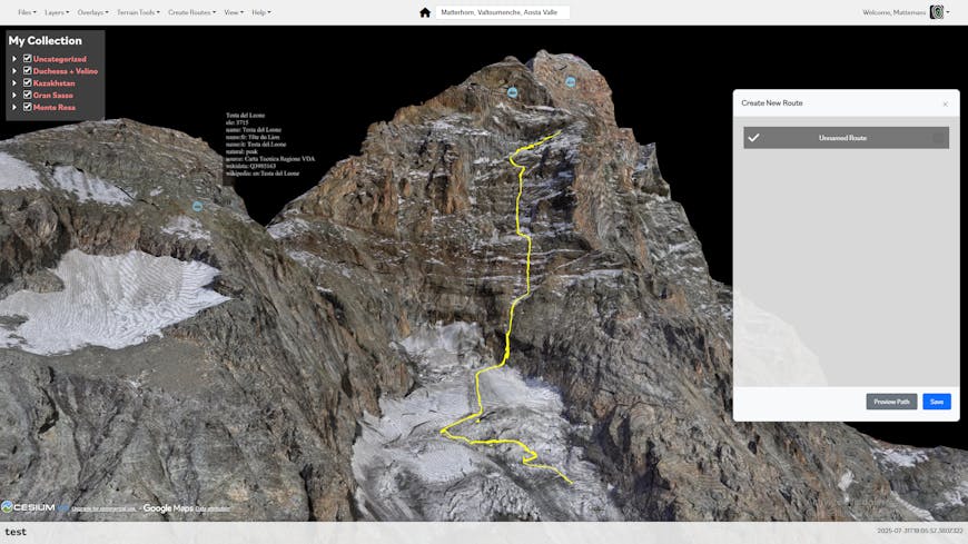
Explorers can create their own routes in Trailamo, dropping waypoints and comparing against public routes, as in this climb of the southwest face of the Matterhorn. Courtesy Trailamo.
Trailamo offers global terrain and imagery for planning an outing anywhere on the planet. Beginning with Cesium World Terrain, users can then choose from a variety of imagery layers, such as topographic maps or satellite imagery. For a photorealistic view of well-known areas, they can also view global Google Photorealistic 3D Tiles.
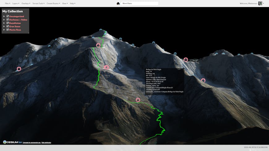
Trailamo aggregates open data, using CesiumJS to give viewers access to public datasets for planning outdoor experiences, as in this view of Mont Blanc in the Alps from the French approach. Courtesy Trailamo.
Above this base, users can add overlays, such as live snow coverage from NASA GIBS, weather data from OpenWeather, ski pistes from OpenSkiMap, hiking trails provided by various collections of public GPX tracks, and more.
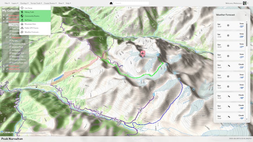
By combining terrain, imagery, and overlays, users can better understand upcoming adventures. Here hiking trails, publicly available routes, ski runs, and terrain contours are all shown with OpenTopoMap imagery draped over Cesium World Terrain at Fizkul Peak in Kazakhstan. Courtesy Trailamo.
Trailamo offers free accounts. Matteo, a strong supporter of open data, believes that high‑quality outdoor tools shouldn’t hide essential information behind steep subscription fees—especially when much of that data is generated by publicly funded government agencies as a public good. If citizens have already paid to collect it, he argues, they shouldn’t have to pay again to access it.
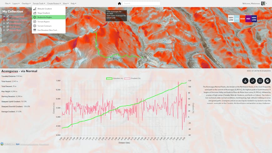
Terrain analysis tools, such as this calculation of avalanche angles at Aconcagua, Argentina, give adventurers a better understanding of their surroundings so they can mitigate their risk in unknown territory. Courtesy Trailamo.
Matteo has also written a number of tools for specialized terrain analysis. Because CesiumJS exposes the quantized mesh in its terrain pipeline, Matteo was able to calculate normal vectors for each triangulated surface and use that calculation to display altitude and slope gradient, avalanche angles, and terrain aspect and contours.
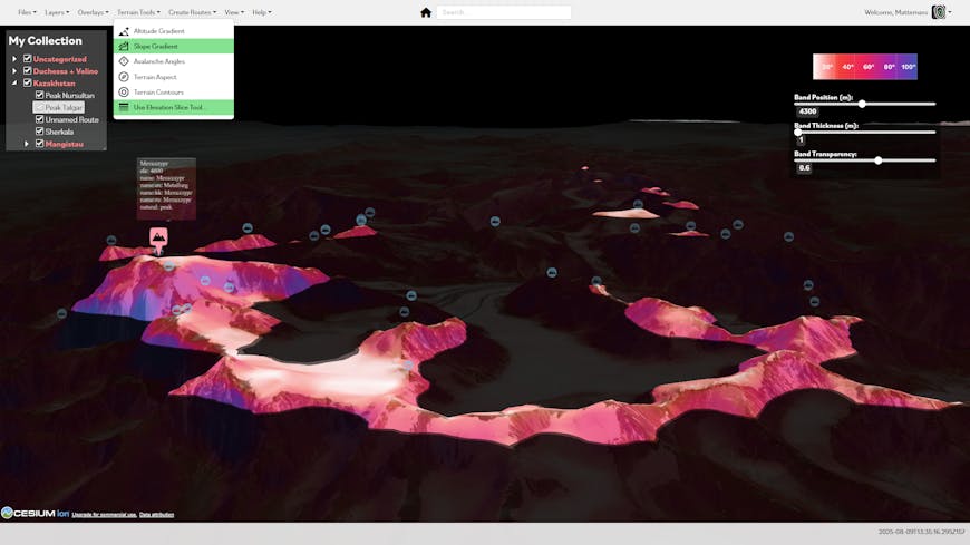
Combining layers and overlays with tools can help users answer very specific questions about planned trips. In this screenshot of the Trans-Ili Alatau range in Kazakhstan, only peaks above a certain altitude are visible, and the slope gradient is colored to give a better understanding of the steepness of the terrain. Courtesy Trailamo.
Because Trailamo uses Cesium to aggregate numerous public datasets into a single app, users can combine them for better insights. This means that skiers can look at runs in their area overlayed with NASA‑collected snow coverage and check for avalanche angles in the backcountry for areas of risk. Hikers venturing into remote areas without widely published guidebooks and trails can look at the 3D terrain and overlay that with GPS tracks collected by OpenStreetMap to infer where others have traveled—quite literally following in past footsteps.
Matteo’s future plan is to continue to expand Trailamo’s data offerings, bringing in more open source data and allowing users to add their own open source imagery or overlays.
To bring together the datasets you care about, sign up for a free Cesium ion account.