Virtual City Systems Advocates Open Source for Urban Digital Twins
CesiumJS forms the foundation of Virtual City Systems’ open, scalable urban planning tools. Virtual City Systems (VCS) has built its modular software suite around CesiumJS to help cities across Europe visualize, analyze, and manage urban spaces in 3D.
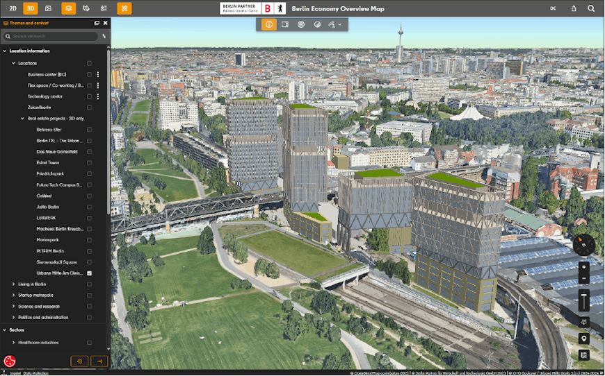
Potential future development in Berlin, Germany, shown as architectural data surrounded by a 3D mesh of existing buildings. Courtesy Virtual City Systems.
VCS, a Cesium Certified Developer, is committed to advancing open tech ecosystems for municipal planning and administration. They were one of the first companies to help promote 3D Tiles as an OGC community standard, and they released VC Map as open source in 2021. This move accelerated adoption and empowered cities to customize and extend the platform freely.
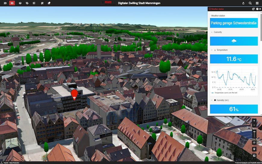
3D visualization of a weather sensor in Memmingen, Germany, along with its real-time temperature and humidity data. Courtesy Virtual City Systems.
A web-based urban twin viewer powered by CesiumJS, VC Map is at the heart of VCS's platform. Cesium allows VC Map to render their users’ large-scale geospatial datasets—terrain, CityGML models, mesh data, and point clouds—efficiently into the browser, enabling smooth, interactive city models for strategic planning and public engagement. VC Map offers both high performance and long-term digital sovereignty for governments.
“With Cesium, we can visualize massive, complex urban datasets responsively and intuitively—and build custom tools on top of a robust, well-supported platform. As a Cesium Certified Developer, we’re proud to promote Cesium as a foundation for transparent, standards-based 3D solutions in the public sector.”
– Claus Nagel, Managing Director & CTO, Virtual City Systems
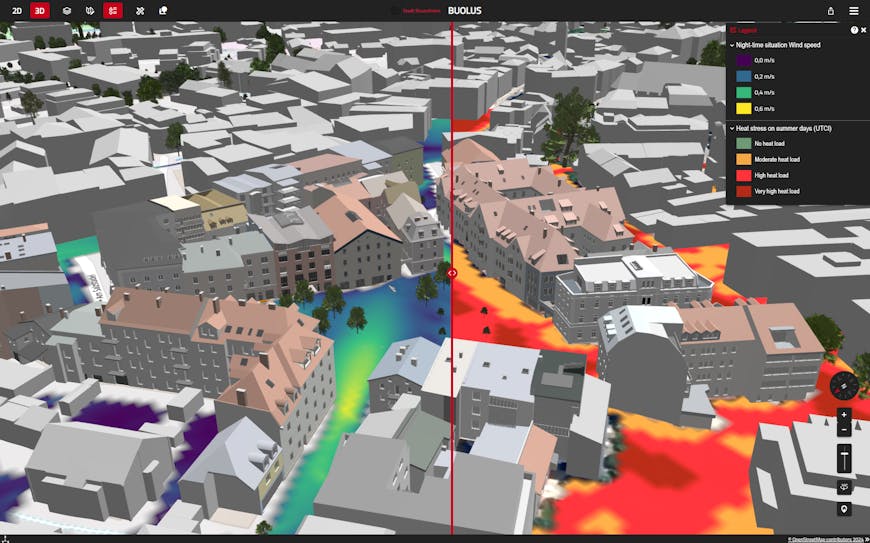
3D visualization of environmental effects of planned buildings in Rosenheim, Germany, showing nighttime wind speeds (left) and summer heat stress (right). Courtesy Virtual City Systems.
VC Map can be extended with a number of modular software solutions. One of the most compelling is VC Solar, a 3D solar potential analysis tool. Built on CesiumJS, VC Solar allows both professionals and citizens to explore rooftop solar viability in 3D.
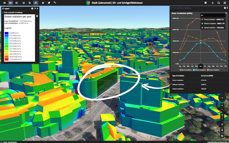
Measuring solar potential in Lüdenscheid, Germany. This visualization uses color on CityGML buildings to visualization annual global radiation. Users can select a single surface to view a graph showing monthly irradiation. Courtesy Virtual City Systems.
Users can assess energy yield, CO₂ savings, and financial feasibility using VCS’s custom sun model and ray-tracing algorithms. These calculations can be run citywide in the backend or interactively in the browser thanks to Cesium’s efficient rendering and extensibility.
Analyzing solar potential in the municipality of Vaterstetten, Germany, with the VC Solar App. Courtesy Virtual City Systems.
Virtual City Systems is able to deliver high-performance 3D visualization and extensibility because of Cesium’s commitment to openness. Whatever your industry, CesiumJS gives you the foundation to create scalable, transparent, and customizable solutions. Explore bringing 3D visualizations in the browser to your users with open source CesiumJS, and learn more about our open standards work.