Hobu's Eptium Visualizes Country-Scale Point Clouds with CesiumJS
Hobu, Inc., with its deep roots in open-source geospatial, has led the contributions of standards and tools such as PROJJSON, ASPRS LAS, Cloud Optimized Point Cloud (COPC), and the Point Data Abstraction Library (PDAL). To enable Hobu’s users to visualize and interact with massive point clouds and raster data, the company developed its browser-based Eptium viewer using CesiumJS.
Eptium builds upon CesiumJS to allow users to directly visualize and interact with COPC and Cloud Optimized GeoTIFF in the browser in 3D. Supporting these archive and transmission formats reduces data duplication and conveniently enables visualization of commonly available cloud content. Eptium makes city- or country-scale point cloud datasets accessible for visualization and analysis on the web, especially for disadvantaged users. Streamlined access to massive cloud-based datasets enables interactivity and understanding for a broad audience, including those in the field or students and professionals using devices without high-end graphics capabilities.
Eptium users can perform multipoint observer line-of-sight (LOS) analysis, generate viewsheds, and export GeoTIFF or SVG images directly from the browser without the need for specialized desktop software. They are able to collaborate by saving and sharing application view state as links. Customers use Eptium as a complete web application, build with it as a JavaScript developer bundle, or directly use it for free by visiting eptium.com and pointing at their own data.
Point cloud and viewshed of Montreal, Canada, in Eptium. Courtesy Hobu.
Distribution of point clouds as COPC eliminates the need for extensive preprocessing or local storage of large files. Eptium consumes COPC data on the fly, converting it into 3D Tiles in-browser for efficient streaming. Eptium optionally uses Cesium World Terrain via Cesium ion and Bing Maps Aerial imagery for additional geospatial context. For a comprehensive picture of areas of interest, this data is fused in CesiumJS, which was built for interactive web apps and scaling for massive datasets.
Eptium, COPC, and CesiumJS also power the moonlidar.com application that Hobu's Connor Manning created in support of NASA’s recomputation of the Moon’s elevation.
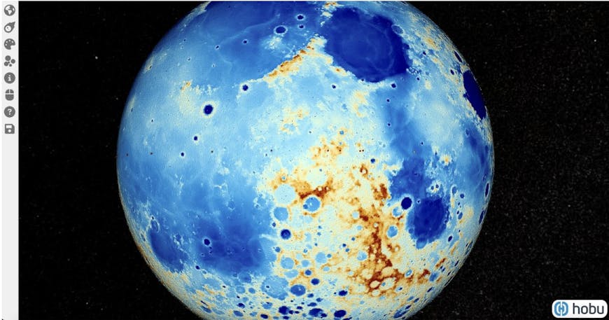
The Hobu team uses CesiumJS for moonlidar.com. Courtesy Hobu.
By combining Hobu's expertise with CesiumJS, the Hobu team empowers geospatial users by making complex 3D data accessible and actionable.
Learn to build your own CesiumJS app for 3D geospatial visualization and analysis on the web by following our tutorials.