Brightline Interactive Uses Cesium for Omniverse for Spatial Computing
To derive additional value from digital twins, Brightline Interactive’s SpatialCore platform pairs AI and the Cesium for Omniverse extension for spatial computing, empowering enterprise and public sector users to combine massive datasets and perform complex calculations. Spatial computing is the use of accelerated compute to analyze and process spatial data, in order to derive insights, make predictions, and perform calculations on one-for-one digital twins.

Leveraging geospatial datasets for AI training and tuning. Courtesy Brightline Interactive.
SpatialCore’s users face challenges in infrastructure, maintenance and operations, and training and simulation. As planners and engineers consider updating roads or building new ones, for example, they can use a SpatialCore-enabled digital twin to estimate how long a road will last, based on where the road is, what it’s made of, typical weather conditions, annual traffic estimates, the weight of those vehicles, and more. As the inputs change, so do the outputs, visualized and analyzed in immersive 3D.
Rapid simulation and calculation enable swift decisions. AI is incorporated into NVIDIA Omniverse-powered workflows to aid calculations, reduce the required technical expertise of users, and train both humans and non-human assets (e.g., drones) with a realistic understanding of Earth.
SpatialCore leverages open data sources and standards for compatibility with a wide range of data and tools. Universal Scene Description (OpenUSD), created by Pixar Animation Studios as an extensible ecosystem for 3D worlds, and 3D Tiles, the Open Geospatial Consortium community standard created by Cesium, are streamed together for precise, scalable 3D scenes for collaboration on a multitude of devices.

Real-time collaboration connecting and empowering teams. Courtesy Brightline Interactive.
“Global enterprise requires a global substrate. In principle, we can’t do what we’re doing without Cesium ion,” said Tyler Gates, general manager of Brightline Interactive.
SpatialCore employs a variety of data sources and tools for its complete picture. Brightline adds its own datasets and those of its clients, such as point clouds from drone scans, to Cesium ion, for hosting in the cloud, tiling into 3D Tiles, and efficiently streaming growing collections of data to Omniverse-powered applications and workflows.
SpatialCore also uses Cesium ion to access Google Maps Platform’s Photorealistic 3D Tiles for line-of-sight visualization and Cesium OSM Buildings for building metadata via the Cesium for Omniverse extension. An accurate, full-scale WGS84 globe is included in the extension and enables SpatialCore’s vital calculations and resulting simulations.

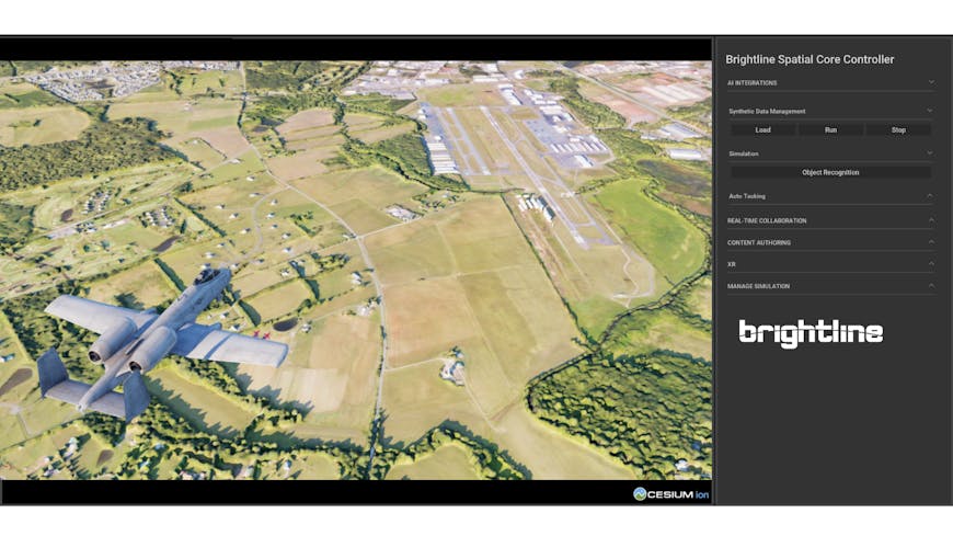
Immersive simulation on top of geospatial data. Courtesy Brightline Interactive.
Brightline Interactive will demo SpatialCore in Cesium’s BOOTH 1831 at GEOINT Symposium 1-5 p.m. ET on Tuesday, May 7, 2024.
Learn more about enabling 3D geospatial capability with Cesium for Omniverse.