Visualize Worldwide Live Ship Traffic with Deepship.AI
Deepship.AI is a live visualization of worldwide ship traffic. Dr. Nils Koesters, FRSA, director of Datafakts Ltd., developed a passion for ships as he lives by the sea and watches them sail past his house in Scotland.
He found several websites that show ship traffic, but all of them were in 2D. To create a compelling 3D view of ship traffic, he settled on Cesium.
The Automated Identification System (AIS) signals, which broadcast where a ship is, are transmitted via VHF and can be received by anyone. So Dr. Koesters installed several AIS receivers, and via software-defined radios got a local feed of what was in front of him. He then found an internet sharing site where in return for sharing his local feed, he could access all other traffic.
There are around 33,000 ships at any one time transmitting 24 different AIS messages in 6 bit ascii. To decode so much data, he uses an adapted open source C program. He then uses an intermediate database to collect information that feeds a PHP invoked CZML stream that is streamed to the web client of the user.
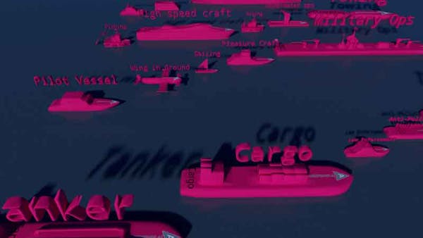
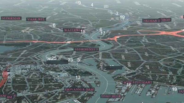
Ships come in different sizes and have different use classes in two different main ship classes. The app contains around 52 different simplified glTF model in two main classes. The ship colors use an Angular Material color scheme to display brightly against the main Angular tile scheme. The 3D icon type models are used so that a user who is close up can immediately identify, for example, a Cargo ship of Class A (commercial) or a sailing ship. Cesium World Terrain is also enabled. 2D Angular tile data is streamed from Dr. Koesters’s server, and there is also a backup OSM raster data server. The site does not operate on the cloud, as the service is non commercial.
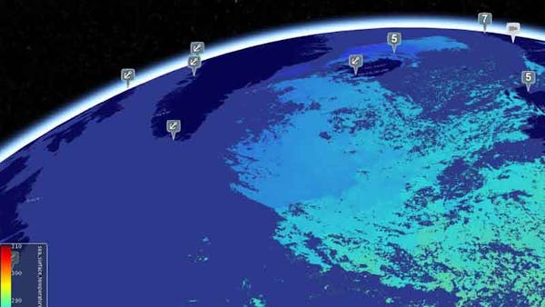
As Cesium enables free layer choice, the user can choose a tiled Angular Material Layer or the maps that come with Cesium. Additionally, Koesters is enabling more and more live ESA satellite images streamed into Cesium via my WMS (Web Map Service) proxy. To keep the 3D load manageable the client can choose a radius from the camera in which ships can be seen; there is no need to see ships in India if the camera view is currently in Greenland. Ships are searchable via an Angular list, with a button to fly users directly to that ship’s position.
The site also includes a Leaflet enabled landing page so that non 3D enabled users can generally see what the site is about, but content there is a JSON pull and not a continuously streamed service.
The deepship.ai service information is also a front end for derivate backends for other ship centered services. Dr. Koesters is working on linking the AIS data to share prices, since 80% of all world commerce is done via ships. Hence the AI in the domain name.