Follow the Air Force and NOAA Hurricane Hunters in Real-Time as they Track Tropical Storms and Hurricanes
Every year tropical cyclones threaten North America, as they do in other places around the globe. Uniquely, the United States has a large fleet of hurricane hunter reconnaissance aircraft that investigate tropical storms and hurricanes that threaten land in North America. The United States Air Force, the National Oceanic and Atmospheric Administration (NOAA), and the National Aeronautics and Space Administration (NASA) all have aircraft that either fly into, around, or above some of nature’s most powerful storms.
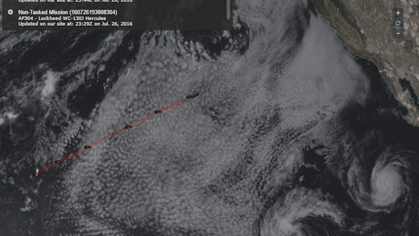
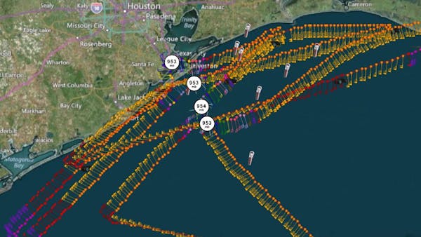
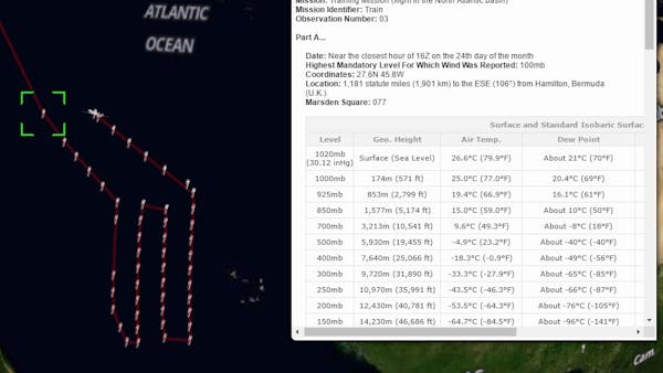
Tropical Globe processes some of the raw data available from many of the hurricane hunter aircraft that investigate these storms. The raw text data our site retrieves in near real-time is decoded from its original form so it can then be displayed and easily viewed. In addition to being able to view the decoded text data, our site maps this data along the flight path of the aircraft, all in near real-time, generating a KML file that can be viewed in both Google Earth and Cesium. This allows people to view where significant observations, such as wind speed, pressure, and temperature, took place along the flight path, all while the flight is occurring. For live missions, you can view satellite data from various sources within our live Cesium display, allowing you to view satellite imagery from near the time the decoded observations took place along the flight path.
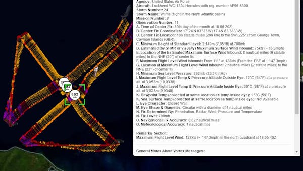
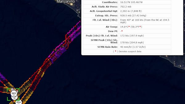
Our site decodes a variety of products that these reconnaissance aircraft transmit. You can view a tutorial about the different products, as well as the different types of aircraft, that you will see on our site. From observations taken at flight level to observations taken by instruments dropped from the aircraft, the hurricane hunters gather a variety of data to help forecasters improve their forecasts. Some of these reconnaissance aircraft also conduct research missions as well as missions in the winter for severe winter storms threatening the coastal United States. Missions can therefore occur anytime of the year, anywhere in North America—not just when tropical storms and hurricanes threaten.
Our site contains thousands of older reconnaissance missions from the North Atlantic, Eastern North Pacific, and Central North Pacific basins, with some of the earliest data available on our site being from 1989. All of these older missions can be viewed in Google Earth and Cesium.
An important note about our site is that most of the products at Tropical Globe are meant to be interpreted by weather professionals and not be directly disseminated to the public. Our site contains links to products that can contain errors, can be unavailable at times, and can also be misleading if not interpreted by a weather professional. For official hurricane information always consult official sources.
Our site originally used the Google Earth plugin to display flight data within a browser. Moving to Cesium gave us the opportunity to look at improving our display, such as adding satellite layers using Cesium’s UrlTemplateImageryProvider. Using Cesium’s Sandcastle and documentation, we were able to determine how to migrate from the Google Earth plugin to Cesium. We’ve been able to migrate all the features of our previous display into our new display. Cesium has been easier to work with given the fact that you have complete control over the code and don’t have to work with a plugin. It was difficult to use HTML panels over the Google Earth plugin. Moving to Cesium has made creating and toggling panels much simpler.