Share Massive Drone Captures Directly from WebODM with Cesium ion
We’re excited to announce that the latest version of WebODM (OpenDroneMap) now ships with support for 3D tiling with Cesium ion.
WebODM allows users to generate point clouds, 3D models, and terrain from aerial images. With this new Cesium ion integration, users can also fuse the data they’ve collected with other geospatial datasets, such as Cesium World Terrain, all placed in an accurate global context.
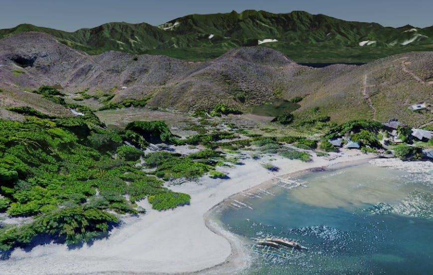
This photogrammetry mesh of Malalison Island, Philippines, was tiled on Cesium ion and fused with the global Cesium World Terrain. See a live demo in your browser. Source data captured by the American Red Cross and processed with OpenDroneMap.
It’s also possible to layer multiple versions of data, which is useful if, for example, you’re monitoring an area by comparing scans from different points in time.
Even though such high resolution 3D data often comes in gigabytes, our new integration makes it easy to tile that data into 3D Tiles and host it with the Cesium ion platform directly from the WebODM dashboard. Piero Toffanin, WebODM software developer, said of the integration:
We’re excited to bring 3D Tiles export functionality into WebODM and look forward to pushing the adoption of open standards like it.
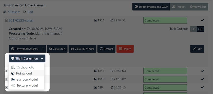
The latest version of WebODM now has a “Tile in Cesium ion” button which will tile and host massive 3D datasets in the cloud.
Cesium ion supports tiling all formats generated by WebODM, whether that’s texture models, point clouds, imagery, or digital elevation models. Try it out with our new WebODM integration tutorial.