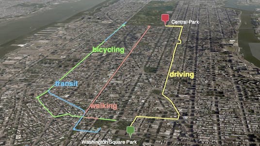
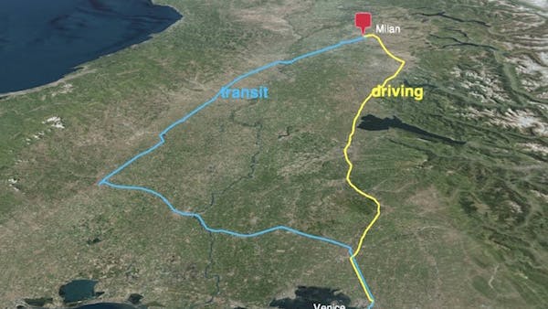
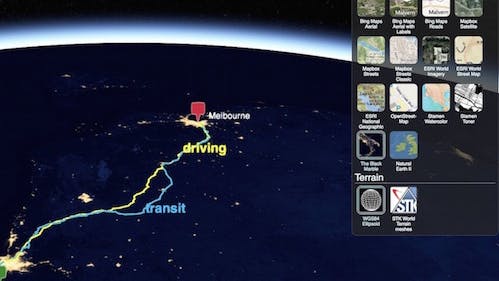
Compare Estimated Travel Times and Directions on a 3D map with Wayfinder3D
Wayfinder3D, developed by Will Geary, is an application for comparing suggested routes and estimated travel times by mode (driving, transit, bicycling, walking) between two locations on a 3D globe. Wayfinder3D fetches directions and travel times from the Google Maps Directions API, converts them into CZML (Cesium’s JSON format for describing a time-dynamic graphical scene), and visualizes them in the browser using Cesium’s 3D globe engine.
Visit Wayfinder3D on GitHub to view the project and instructions on how to use the application. Follow Will on Twitter at @wgeary for updates and other projects.