Interact with Categorized Stories of Queensland's Economy on The Cube Globe
The Cube, built by the Queensland University of Technology (QUT), is a giant interactive display built of 48 touchscreens that makes many educational projects accessible to the public. One of these projects is the Cube Globe, an interactive visualization experience based on the Cesium WebGL globe engine. It was developed for the 2014 G20 Leader’s Summit in Brisbane, Australia, by the Visualization and eResearch (ViseR) group, located within the Institute for Future Environments at QUT, in partnership with the Queensland state government.
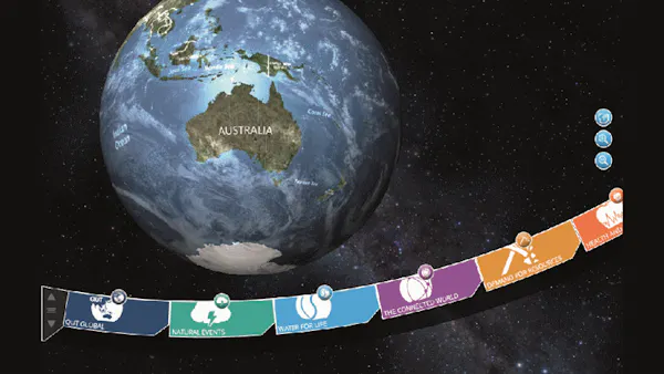
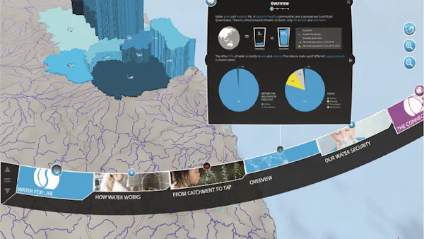
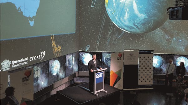
Knowing that people from all over the world would be coming for the summit, the ViseR group developed the Cube Globe to help an international audience better understand and contextualize key elements of Queensland’s economy. The Cube Globe uses data provided by the state to present stories using a range of data visualization techniques and an assortment of integrated media. Through the use of spatial data visualization, animation, and touchscreen interaction, the globe encourages users to explore their place in the world via a novel, story-based interface. Stories are presented through key categories, and users can interact with statistical and spatial data while observing global connections.
Though the summit is over, the Cube Globe remains a constantly evolving project. Since its inception, the Cube Globe has had multiple deployments in a variety of formats, on both large and smaller-scale interactive screens. It is regularly deployed at events for public engagement and serves as a valuable tool for teaching and research at QUT. Updates to the software continue to improve the experience, with additions such as
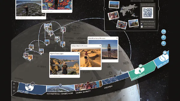
- Flux line sequences for displaying journeys and ordered location linkages,
- Media map pins, displaying photos and videos at the location they were recorded,
- Historical data additions, such as mapping the history of Brisbane’s floods via state government data, and
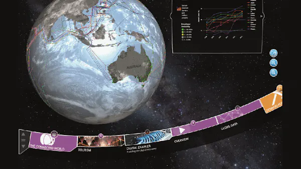
- Global resources and infrastructure, based on open source and government data.
The software and data management has been made possible using a range of technologies and tools, including Cesium, CartoDB, PHP, MongoDB, ArcGIS, QGIS, Geoserver, and Adobe Illustrator.