 |
Cesium for Unity 1.26.0
|
|
Cesium for Unity 1.26.0
|
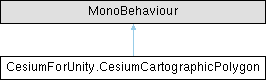
A spline-based polygon used to rasterize 2D polygons on top of Cesium3DTilesets. More...
Public Member Functions | |
| delegate void | CartographicPolygonLoadFailureDelegate (CesiumCartographicPolygonLoadFailureDetails details) |
| Encapsulates a method that receives details of a cartographic polygon load failure. | |
| void | Refresh () |
| Reloads the polygon's spline from the configured source and rebuilds any CesiumPolygonRasterOverlay that references this polygon, so the cutout in the tileset matches the latest data. | |
Properties | |
| CesiumCartographicPolygonSource | source [get, set] |
| The source from which this polygon's shape is derived. | |
| string | url [get, set] |
| The URL from which to load the GeoJSON document. | |
| int | polygonIndex [get, set] |
| The zero-based index of the polygon to use when the source geometry is a MultiPolygon. | |
| int | featureIndex [get, set] |
| The zero-based index of the feature to use when the GeoJSON root is a FeatureCollection. | |
| long | ionAssetID [get, set] |
| The ID of the Cesium ion asset to use. | |
| string | ionAccessToken [get, set] |
| The access token to use to access the Cesium ion resource. | |
| CesiumIonServer | ionServer [get, set] |
| The Cesium ion server from which this polygon's GeoJSON is loaded. | |
| CesiumGeoJsonDocument | document [get, set] |
| Gets or sets the GeoJSON document used by this polygon. | |
Events | |
| static CartographicPolygonLoadFailureDelegate | OnCesiumCartographicPolygonLoadFailure |
| An event that is raised when the polygon encounters an error that prevents it from loading. | |
A spline-based polygon used to rasterize 2D polygons on top of Cesium3DTilesets.
Cartographic polygons are only supported for Unity 2022.2 or later.
The polygon's shape is defined by a spline that is georeferenced using a CesiumGlobeAnchor. The spline can either be edited manually, or its knots can be generated automatically from a GeoJSON document loaded from Cesium ion, a URL, or a document that has been parsed and assigned in code.
Definition at line 60 of file CesiumCartographicPolygon.cs.
| delegate void CesiumForUnity.CesiumCartographicPolygon.CartographicPolygonLoadFailureDelegate | ( | CesiumCartographicPolygonLoadFailureDetails | details | ) |
Encapsulates a method that receives details of a cartographic polygon load failure.
| details | The details of the load failure. |
|
inline |
Reloads the polygon's spline from the configured source and rebuilds any CesiumPolygonRasterOverlay that references this polygon, so the cutout in the tileset matches the latest data.
This has no effect on the spline when source is set to CesiumCartographicPolygonSource.Manual, but dependent raster overlays are still rebuilt so that manual edits to the spline are reflected in the cutout.
Definition at line 383 of file CesiumCartographicPolygon.cs.
|
getset |
Gets or sets the GeoJSON document used by this polygon.
Setting this property automatically changes source to CesiumCartographicPolygonSource.FromDocument.
Definition at line 271 of file CesiumCartographicPolygon.cs.
|
getset |
The zero-based index of the feature to use when the GeoJSON root is a FeatureCollection.
If the root object is a single Feature, this value is ignored. If the index is out of range (negative or >= the number of features), the cutout will not be applied and any previous cutout will be cleared. Setting this property triggers a reload when a non-Manual source is active.
Definition at line 176 of file CesiumCartographicPolygon.cs.
|
getset |
The access token to use to access the Cesium ion resource.
Only used when source is set to CesiumCartographicPolygonSource.FromCesiumIon. If empty, the default token from the ion server will be used.
Definition at line 220 of file CesiumCartographicPolygon.cs.
|
getset |
The ID of the Cesium ion asset to use.
Only used when source is set to CesiumCartographicPolygonSource.FromCesiumIon.
Definition at line 196 of file CesiumCartographicPolygon.cs.
|
getset |
The Cesium ion server from which this polygon's GeoJSON is loaded.
Only used when source is set to CesiumCartographicPolygonSource.FromCesiumIon.
Definition at line 243 of file CesiumCartographicPolygon.cs.
|
getset |
The zero-based index of the polygon to use when the source geometry is a MultiPolygon.
If the source geometry is a simple Polygon, this value is ignored. If the index is out of range (negative or >= the number of polygons in a MultiPolygon), the cutout will not be applied and any previous cutout will be cleared. Setting this property triggers a reload when a non-Manual source is active.
Definition at line 154 of file CesiumCartographicPolygon.cs.
|
getset |
The source from which this polygon's shape is derived.
Setting this to CesiumCartographicPolygonSource.FromCesiumIon, CesiumCartographicPolygonSource.FromDocument, or CesiumCartographicPolygonSource.FromUrl will reload the polygon's spline from the configured GeoJSON source. Setting it to CesiumCartographicPolygonSource.Manual leaves the current spline as-is, allowing it to be edited by hand.
Definition at line 109 of file CesiumCartographicPolygon.cs.
|
getset |
The URL from which to load the GeoJSON document.
Only used when source is set to CesiumCartographicPolygonSource.FromUrl.
Definition at line 129 of file CesiumCartographicPolygon.cs.
|
static |
An event that is raised when the polygon encounters an error that prevents it from loading.
Definition at line 75 of file CesiumCartographicPolygon.cs.
 1.13.2