New CesiumJS Tutorial: Hide Regions of 3D Tiles or Terrain with Clipping Polygons
We’ve just added a new tutorial to our learning center that covers how to hide regions of 3D Tiles or terrain with clipping polygons. You can use this technique to combine datasets in CesiumJS, such as placing your own high resolution photogrammetry model in context with Google Photorealistic 3D Tiles or Cesium World Terrain.
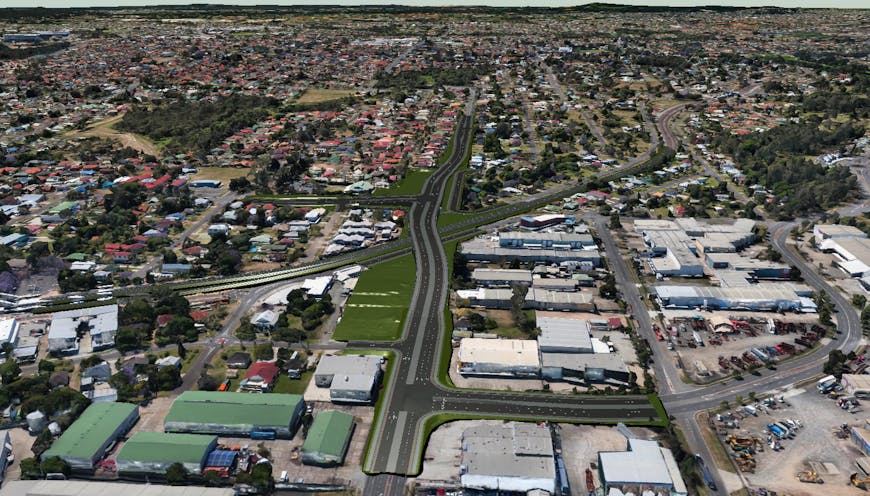
A 3D Tiles design model of a road inset into Google Photorealistic 3D Tiles in CesiumJS using a ClippingPolygon.
ClippingPolygons are used to selectively hide regions of either 3D tilesets or terrain. This feature is useful when isolating areas of interest in a global dataset, adding overlapping tilesets such as a design model inset into an existing dataset, and more.
Follow the tutorial, and share your work and any questions with us on the community forum.