3D Model of the historical section of Catalonia, Spain
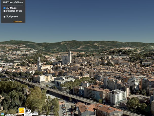
This application is a 3D Model/Rendering of the Old Town of Girona, a historical section of Catalonia, Spain. It’s a good example of combining data collected from numerous sources and converting them to a unified format for Cesium.
Terrain and Imagery
We collected all our own elevation and model textures. The Institut Cartogràfic i Geològic de Catalunya (ICGC) provided an airplane so we could attach our oblique photogrammetric camera to it during a flight in October 2014.
The base image layer is the orthophoto of Catalunya which is freely available from ICGC’s WMTS service.
Models
We exported the models from Acute3D to COLLADA with a level Of Detail (LOD) 18. We then combined the 42 COLLADA models into glTF models, and generated a single CZML file to construct the whole scene in Cesium. We also clamped all the models to ICGC’s own 5x5 m DEM that covers Catalunya.
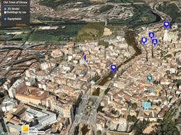
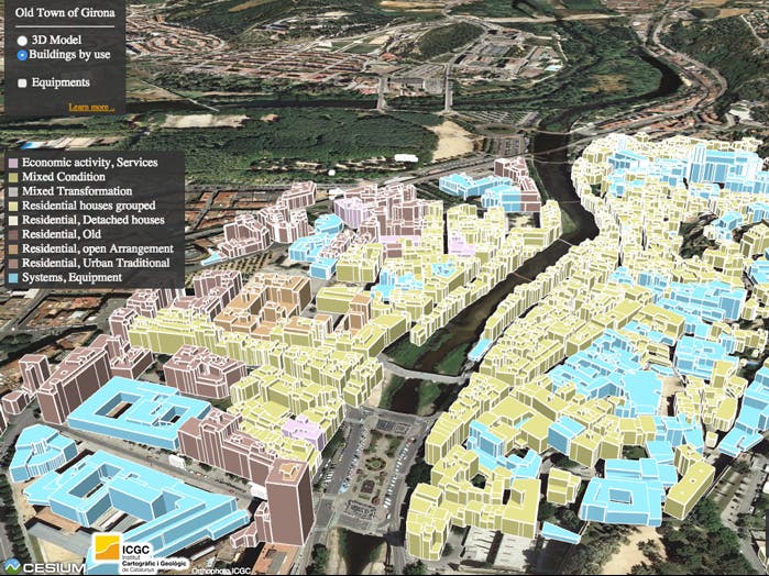
Data Points
Along with the standard 3D models with photographic textures, this prototype includes a cube view of the buildings within Girona and their usage (zoning).
We generated this cube view by parsing information provided by Catastro of Spain. Intersected that information with the planning map of Catalunya (MUC), provided the by Departament de Territori i Sostenibilitat de la Generalitat de Catalunya. You can view this information by clicking on any building model.
We also included a set of markers for landmarks within the Old Town.
All in all, a combination of six different data sources, in different formats and from different origins created this single model with three layers of information. Although big and complex, the prototype performs well in any modern browser.