NICTA uses Cesium in the Subspace Project for a Growing Number of 3D Geospatial Visualization Initiatives
NICTA (National ICT Australia) is Australia’s largest Information and Communication Technology Centre of Excellence. NICTA is using Cesium on a growing number of initiatives involving web-based 3D geospatial visualization. The Subspace project at NICTA is building functionality into Cesium to support these initiatives. NICTA project areas using Cesium include:
- environmental monitoring and analysis;
- transport and infrastructure modelling, simulation and optimisation; and
- consumer broadband applications.
NICTA is contributing functionality back to the core Cesium codebase where this would be useful for other applications. This includes functionality in areas such as tile map services, terrain handling, and data visualization.
The video below shows some of the uses of Cesium at NICTA including:
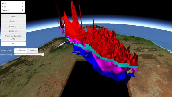
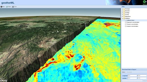
- Geothermal data fusion: Interactive visualization of fused sensor data from a range of geo sensors to indicate possible sources of “hot rocks” for potential geothermal energy;
- Groundwater modelling: Modelling ground water reservoirs and the change in these over time;
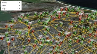
- Smart infrastructure: Modelling, monitoring, simulating and optimizing smart infrastructure; and
- Transport network visualization: Modelling, simulating, visualizing and optimizing transport networks (including live GPS feeds of transport).
For more details, email subspace@nicta.com.au.