Using Cesium for Map-Based Access to Australian Spatial Data with Australia's National Map
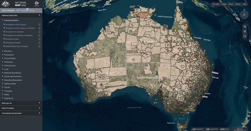
NICTA(National ICT Australia) is using the Cesium JavaScript library in their National Map software for map-based access to Australian spatial data from government agencies. The National Map is an initiative of the Australian Commonwealth Government’s Department of Communications and the software has been developed by NICTA working closely with the Department of Communications, Geoscience Australia and other government agencies.

The National Map is a fully open architecture with data accessed directly from the government department or agency that is the custodian of the data (for example, data relating to “broadband availability and quality”, is accessed directly from the Department of Communications; data relating to surface geology is accessed directly from Geoscience Australia; national data relating to water is accessed directly form the Bureau of Meteorology; etc.). Access to data is done using OGC (Open Geospatial Consortium) standard protocols. The National Map itself does not store any data - it provides a map-based view to data that is stored by a growing number of Australian government bodies at all levels of government. It also can get lists of data sets directly from open data catalogues which are hosted using the CKAN software including http://data.gov.au and http://data.vic.gov.au.
Find the National Map source code on GitHub.
NICTA is contributing functionality back to the core Cesium codebase where this would be useful for other applications. This includes functionality in areas such as tile map services, terrain handling, and data visualization.
To discuss it in more detail, email nationalmap@lists.nicta.com.au.